

In the Victorian hiking community, there are a few universal truths about the Lerderderg National Park that some people learn the hard way. First up: the map will feel like it is lying to you. A 5km loop on paper easily sucks up the time, sweat, and leg-burn of a 20km walk on the flat.
It’s just brutal terrain. Many signs of a clear track disappears pretty fast, turning into steep, ugly 300-metre climbs up loose gravel spurs where you're basically guessing the way by spotting faded pink ribbons tied to trees.
Once you drop down into the gorge itself, you can forget about a trail entirely. It's can be hours of relentless rock-hopping, scrambling over boulders, and wading through freezing water that will test your ankles and your patience.
And phone signal? Dicey at best. If you didn't download offline maps, you could find yourself hiking blind.
The main truth about Lerderderg is that it doesn’t compromise. It's a wild, unforgiving place that loves to humble overconfident hikers, and you’re pretty much guaranteed to walk out with a few bruises, soaked boots, and a lot more respect for the bush.
Anyone who has spent time in the Lerderderg Gorge and Werribee Gorge near Bacchus Marsh knows they have a reputation for rough, unforgiving terrain. What catches people out, however, isn't just the steep climbs or the rocky riverbeds, it’s how quickly the environment changes. Heavy rains alter watercourses, footpaths wash away on loose scree, and a route that was straightforward a few seasons ago can quietly turn into a serious scramble.
Three incidents from this last weekend show exactly why you can never treat Lerderderg or Werribee Gorge as a routine outing.
Bunerong Bushwalking Club: A 5-Hour Walk Turns into 9 Hours
While many Victorian clubs were away at the annual Federation weekend, four members of the Bunerong Bushwalking Club used the opportunity to head out to MacKenzies Flat picnic reserve to preview the Lerderderg Gorge loop.
Previewing routes is standard club practice for good reason. Bunerong had run this exact circuit a few years back without issue, but they soon found that conditions on the ground had altered dramatically:
-
Submerged Crossings: Higher river levels had submerged the stepping stones walkers usually rely on, leaving the team with wet boots and socks from early in the trip.
-
Track Degradation: The steep inclines and declines throughout the gorge had deteriorated heavily, requiring far more cautious footwork and navigation than on previous outings.
-
Timeline Blowout: Even with an experienced, small party, a walk that used to run comfortably between 5 and 6 hours blew out to nearly 9 hours.
Because those four members took the time to scout the trail, the club was able to make the call: the track is simply not suitable for a general club trip right now. It is a credit to the leaders who volunteer their weekends to do this unglamorous legwork, keeping members off routes that have become unsafe.

High Angle Rescue at Grahams Dam - Lerderderg National Park
Just as Bunerong's hikers were navigating their swollen crossings and deteriorated trails, another party of four in Lerderderg found out how unforgiving the terrain can be when route-finding goes wrong.
Near Grahams Dam, the hikers mistook a side track for an alternate route. In the gorge, faint tracks often look like easy ways around river obstacles, only to funnel walkers straight up onto steep bluffs with no safe way back down. The group ended up stranded 50 to 60 metres up a sheer cliff face, in a life-theatening situation.
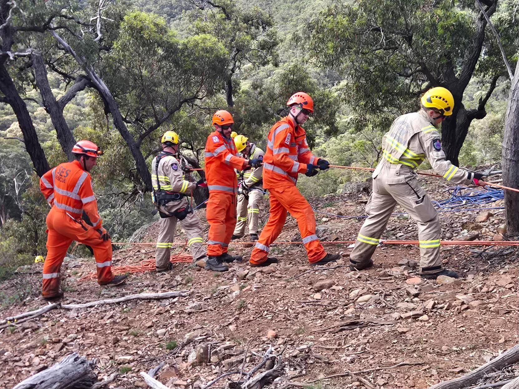
There was no walking them out. Rescuers had to deploy specialised high-angle rope systems to haul all four hikers up the cliff face to safety. The operation pulled in crews across multiple agencies, including the volunteers from the Bacchus Marsh SES, FRV, CFA, Ambulance Victoria, and Victoria Police.
Helicopter Extraction in Werribee Gorge
It wasn't just Lerderderg catching walkers out that weekend. Just down the road at Werribee Gorge, another hiker sustained a severe ankle injury.
In a lot of parks, a rolled ankle means a slow, painful walk out or a stretcher carry. But gorge terrain changes things. Due to the hiker's inaccessible location, ground crews couldn't safely extract them. After finding and stabilising the patient, Bacchus Marsh SES volunteer Search and Rescue crews and Ambulance Victoria Paramedics had to call in an Ambulance Victoria HEMS Helicopter to winch the patient out.

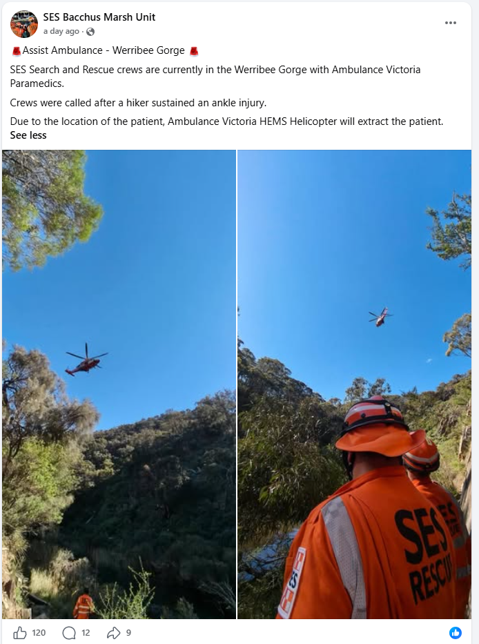
If there's one major takeaway from this weekend, it's the sheer pressure these incidents put on our local volunteer rescue crews. The SES Bacchus Marsh Unit was at the centre of the weekend's chaos. Replying to a local thanking them for their incredible work, the unit shared their call-out sheet. In just a 24-hour period, their volunteers responded to:
-
2 Road Rescues
-
2 Searches
-
1 High Angle Rescue
As the unit rightly noted online, they were definitely "hoping for a bit of a rest!" Hikers owe it to these volunteers to be as prepared as possible so we don't add to their workload.
Lessons for Hikers and Group Leaders
Lerderderg and Werribee Gorges sit right on Melbourne’s doorstep, which often gives hikers a false sense of security. If you are planning a trip out that way, keep a few realities in mind:
-
Old trip notes expire quickly. Floods and erosion regularly shift gravel bars, wash out riverbanks, and erase markers. Don't rely on memory or a track log from three years ago.
- Research your hike using multiple sources. Don't just rely on a single map app, all trails, an instagram post or an old blog post. Cross-reference your plans by checking the Parks Victoria website for current closures or warnings, reading recent trip reports on walking forums, and looking at recent track logs on GPS apps. Combining official topographic maps with up-to-date, on-the-ground feedback gives you a much clearer picture of what you're actually walking into.
-
Previews matter. Bunerong’s experience proves the value of sending an experienced party out first. If a small, fit group takes nine hours on a six-hour trail, a larger group will likely get caught out after dark.
-
Be wary of "easy" bypasses. When river levels are high, it’s tempting to scramble up valley walls to avoid deep water. That often leads onto crumbly, loose rock that dead-ends into a vertical drop.
-
A simple injury can mean a helicopter rescue. As we saw in Werribee Gorge, the steep, rocky terrain means you can't easily be stretchered out. Step carefully. And make sure you have Ambulance Victoria membership.
-
Pack for the extra hours. If an unexpected trail blowout can add three to four hours to your day, head torches, extra food, adequate water, and an emergency communication device (like a PLB) aren't optional extras, even on a familiar loop.
- Tell someone where you are going, what route you are taking, when to expect you to contact them, what equipment you are carrying, and where you have parked. If you do need a rescue, this information can save rescuers hours of searching.
For comprehensive safety advice and trip checklists, check out the full safety guidelines on the Advice for Safe Bushwalking.