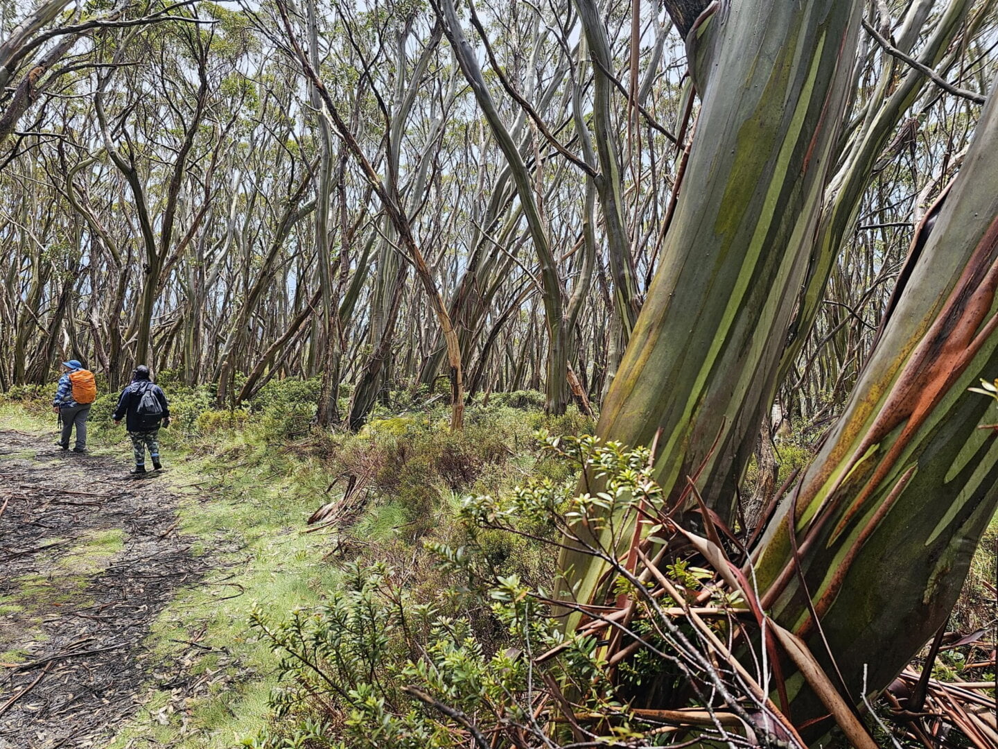
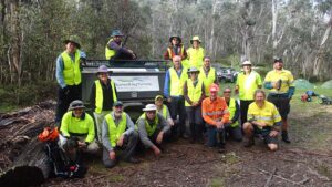
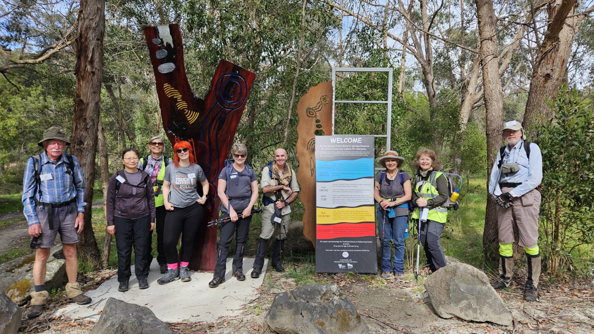
Posted on

A Glimpse of the Great South West Walk

A Glimpse of the Great South West Walk

This film features the insights and experiences of three walkers who traveled through this rugged and beautiful landscape. This unforgettable journey winds around three National Parks, the pristine Glenelg River and the vast Southern Ocean.

The 2026 Fedwalks event is hosted by the Friends of the Great South West Walk, based out of Portland, Victoria.  Open to bushwalking club members and Bushwalking Victoria individual members, we are looking forward to seeing sections of the walk in ways only the locals can show you.  Keep the 10-11th of October, 2026 free in your calendar.

Thank you to everyone who contributed to the making of this production, including the Friends of the Great South West Walk, the Portland Field Naturalists Club, Powerhouse Productions, Glenelg Shire Council and the many volunteers who assisted in so many ways.

Get more details on the Great South West Walk, or walk with the Friends of the Great South West Walk.

Posted on

Learning to Lead with Confidence: Inside BWV’s Walk Leader Training

Bushwalking Victoria invited us to attend the BWV Walk Leader Training, and what an incredible and rewarding experience it turned out to be! It was a fantastic opportunity to learn, grow, and gain valuable knowledge that will help us lead hikes more safely and confidently in the future.

The training covered a wide range of essential skills. One of the highlights was learning how to properly use a compass alongside a map for navigation. Even though modern navigation apps are widely available, the training reinforced how important it is to understand traditional navigation methods, especially in remote areas where technology can fail or signals can drop. It was both fascinating and empowering to develop these practical skills.

We also learned in detail about what it truly takes to lead a hike successfully. From planning routes, assessing risks, managing group dynamics, and ensuring participant safety, to preparing for different environmental and weather conditions – the session gave us a much deeper understanding of the responsibilities that come with leading outdoor adventures.

Another extremely valuable part of the training focused on emergency preparedness. We were guided through how to respond if an injury or accident occurs during a hike, including how to stay calm, assess the situation, provide immediate assistance, and coordinate help when required. These are critical skills that can make a real difference in ensuring everyone’s safety on the trail.

It was a long and intensive day filled with learning, discussions, and hands-on activities, but every moment of it was absolutely worth it. We walked away with new knowledge, improved confidence, and a stronger sense of responsibility as hike leaders.

We sincerely thank Bushwalking Victoria for providing us with this amazing opportunity and for their continued support in helping build safer and more skilled outdoor communities. We are truly grateful and excited to apply what we learned in future hikes and adventures.

Author: The Hiking Tribe

Note from Bushwalking Victoria:

Bushwalking Victoria organises Leader Training days several times a year for affiliated clubs and individual members.  Dates are usually announced in the Bushwalking Victoria Newsletter.  Subscribe Here.

In addition, Bushwalking Victoria has produced the online Bushwalking Victoria Leader Resources.  While these resources are intended to support leadership within bushwalking clubs, the practical advice, reference material and learning activities can also act as a prompt to individuals wishing to arrange and conduct group walks in the Australian bush.

There is no substitute for actually leading a walk. Most organised bushwalking clubs will arrange for a new leader to work with an experienced mentor. Use the resources on this site to guide your thinking about how to prepare and what to do as a leader of a group on a bushwalk.


Posted on

If you could give your “beginner hiker self” one piece of advice – what would it be?

Sometimes the best advice doesn’t come from manuals or gear lists. It comes from people who’ve learned the hard way, one step at a time. Recently, the Facebook page Hike Like a Woman asked its community a simple question: “If you could give your "beginner hiker self" one piece of advice, what would it be?”

The responses poured in. Practical. Honest. Encouraging. Occasionally hard-earned. Together, they form a brilliant beginner’s guide, straight from the trail.

Here are the key lessons that came through loud and clear.

1. Hike Your Own Hike

  • Again and again, walkers reminded beginners that it’s not a race.
  • Go at your own pace. Take breaks. Stop comparing your distance, speed or fitness to others. Some days you’ll fly, some days you’ll crawl. Both count.
  • Put one foot in front of the other. Slow down. Look around. Enjoy the journey, not just the destination.

2. Shoes and Socks Matter (A Lot)

If there was one unanimous theme, this was it.

  • Wear shoes with good grip
  • Buy footwear that fits you, often half to one size bigger
  • Don’t wear brand-new boots on a big walk
  • Wool socks are worth the investment
  • Some swear by boots, others by trail runners or sandals in warm weather.
  • There’s no single “right” answer, just what works for your feet.

3. Poles Are Not Cheating

  • Hiking poles came up over and over, especially for downhill sections.
  • They help with balance, reduce strain on knees and hips, and can make long days far more comfortable. Many wished they’d started using them earlier.
  • A common tip from the community was to learn how to use poles properly, because technique really matters.

4. Carry Less, But Carry Smart

  • “You don’t need as much as you think you do” was a recurring refrain.
  • Lighten your pack where you can, but don’t skip the essentials. Carry the basics, including first aid, and think about how far you’ll have to carry every item you bring.
  • As one walker put it, know what to carry, when to carry it, and how many kilometres you’ll carry it for.

5. Eat, Drink, and Rest Before You Think You Need To

  • Hydration and fuel matter more than beginners often realise.
  • Drink before you feel thirsty.
  • If you’re suddenly exhausted, stop and eat. You’re probably hungry.
  • If you think you’ve brought enough water, bring a bit more.
  • Small snacks, regular breaks, and enough sleep before a hike all add up to a safer, happier day out.

6. Prepare, But Don’t Wait Forever

  • Preparation matters. Planning matters. But so does actually getting out the door.
  • Half the battle is starting. Don’t wait until everything feels perfect. You’re stronger than you think, and experience is the best teacher.
  • Plan properly, then go.

7. Safety Comes Before Summits

  • Several comments reminded beginners that the mountain will always be there.
  • If conditions aren’t safe, turn back. If the weather changes, adjust your plans. There’s no shame in choosing another day.
  • Being prepared also means knowing when not to continue.

8. Solo or With Others, Both Are Valid

  • Some encouraged hiking with a buddy. Others spoke passionately about solo walking.
  • The consensus was clear. Both are fine, as long as you plan appropriately, know your limits, and take responsibility for your safety.
  • There’s no single “right” way to experience the trail.

9. Strength, Stretching and Recovery Matter

  • Bushwalking isn’t just about walking.
  • Stretch regularly. Strengthen feet, ankles and joints. Build strength off the track as well as on it. Your body will thank you, especially on the descents.

10. Be Present

Finally, beyond gear and technique, many people shared something deeper.

  • Stop. Look around. Put yourself in the way of beauty. Be open to discomfort, healing, joy, and the quiet moments that happen between footsteps.
  • For many, bushwalking becomes more than exercise. It becomes a way to reconnect.

One Last Piece of Advice

  • Just go.
  • Don’t wait. Don’t overthink it. Hike more often. Enjoy every step. It’s almost always worth it.

With thanks to the community at Hike Like a Woman for sparking the conversation and generously sharing their hard-earned wisdom.

Posted on

Magical Mountain Mystery Tour trip report

Bayside Bushwalking Club returned to Mount Howitt for its annual four-day walk, after a two-year break.  Sometimes we don’t make it because of bushfires, road closures or the occasional bout of horizontal hail!

On day one, Paul, Louise, Margaret, Rosie and I walked the 5 km into the Macalister Springs campsite and set up camp for the next three nights.  At around 3 am, a spectacular lightning and thunderstorm swept through, bringing a short but intense downpour.  Fortunately, everyone stayed warm and dry, and the weather remained kind for the rest of the trip.

A misty start for the intrepid bushwalkers (Photo: Rosie Erlandsen)


Mist, Mountains and Memories

On the final day of 2025, we headed North along the Cross Cut Saw towards Mount Buggery.  Low cloud lingered all day, limiting the mountain views to occasional fleeting glimpses, but this added to the atmosphere.  A highlight was spotting a rare grey currawong.

Back in camp, we caught up with a lovely family whom Paul and Louise had met 5 years earlier, when the boys, Martin and Owen, were just 3 and 5 years old.  Owen delighted us by making cute little grass wreaths and left them around the Vallejo Gantner hut and trees for us to discover.

Loo with a misty view (Photo: Jeff McDonell)


New Year’s Eve on the Track

That evening, we celebrated NYE with Hannah, who was walking the Australian Alpine Walking Track (AAWT) solo from Canberra to Walhalla – an impressive 35-day journey!  She appreciated the company on New Year’s Eve and we were later pleased to see that she successfully completed the entire walk.  Well done, Hannah!  We attempted to celebrate New Zealand New Year’s Eve at 9 pm, but I think we were all in bed by about 8.30.

The Viking with walkers bottom left (Photo: Jeff McDonell)


Starting 2026 on the Right Foot

We welcomed 2026 by heading up Mount Howitt, continuing the tradition of  a celebratory drink at the summit and starting the year ‘on the right foot’.  Clear skies rewarded us with magnificent views across to Mount Buller, Mount Speculation, The Viking, Mount Beauty and beyond.

As planned, we then headed south towards Mount Magdala.  After a couple of hours walking, we opted for an early lunch with a leisurely stroll back to camp.

A Fitting Finish

On our final night, we shared the last of our New Year’s Eve treats we had carried in and spent an enjoyable evening of conversation before another early night.  Day four was an easy 5 km walk back to the Mount Howitt car park – thankfully no flat battery this year-  with lighter packs and lighter minds for having camped out for 4 days while enjoying the natural beauty of the Australian bush.

It was a magical trip, with magnificent alpine views, a mysterious day wrapped in mist, with the early alpine wildflowers brightening the landscape.  Here’s hoping we’ll see you there next year.

Early alpine wildflowers (Photo: Rosie Erlandsen)


Report by Jeff McDonell

Posted on

Victorian Bushfires – Show your support by staying away + supporting responsibly

After the recent bushfires across Victoria, it’s important to be clear: now is NOT the time to go sightseeing or travelling through fire-affected areas.

Communities impacted by fire are dealing with shock, trauma and enormous uncertainty. Roads, tracks and infrastructure are damaged, there's 1000's of dangerous trees, access is restricted, and recovery will take time. Driving into affected towns, parks or remote areas adds pressure where it’s least needed, and can put you and others at risk.

If you’re feeling the urge to “go and help,” please pause. Don’t force donations or supplies onto communities. Many communities don't have storage space for bulk donations.  The best way to support recovery is respond to specific requests, or ask what’s needed, how people want support delivered, or to donate through channels listed below, which ensure help reaches the right places at the right time.

For walkers, campers, 4WDers and outdoor users considering rural travel:

  • Download the Vic Emergency App on your smartphone (be sure to set up your warning areas)
  • Avoid all fire-affected and recently burned areas (use the Vic Emergency app map view, use the filter to show "Impact Areas")
  • Plan trips carefully to steer well clear of closed parks, tracks and roads (links below).

  • Parts of the Alpine and the Otway National Parks are still burning and will continue to burn for some time. Carefully consider your plans - the tracks will still be there next year for your adventure.

  • Remember weather forecasts aren’t just about temperature - wind strength and wind direction matter.  Use the wind filter on the BOM app, or download the Windy app.
  • If you’re wondering “Do I or don’t I?”  The answer is don’t.

This is only the start of the fire season. The safest and most responsible choice right now may be to stay home - clean your gear, patch that tent, review your maps, and plan future trips for when communities and landscapes are ready to welcome visitors again.

Save your “empty esky”, your "epic hiking" or "amazing 4x4" trips for later. Right now, the bush - and the people who live in it - need space.

Parks and Road Closures:

Supporting Communities

Supporting volunteer CFA and SES Emergency Services

Other Resources:

Posted on

Mt Bogong Adventure – Ben Cruachan Bushwalking Club

East Gippsland based bushwalking club, Ben Cruachan Walking Club, recently headed to Mt Bogong for a club adventure.  Here’s the story of their achievement:

One of the unique aspects of bushwalking is the capacity to feel both humbled and exhilarated in equal measures. And the recent walk up Mt Bogong achieved just that.

Mt Bogong, at 1986m, is Victoria’s highest peak and often on The List for hikers who seek a serious challenge.  And the quiet ‘chuffed-ness’ that comes from reaching such an iconic summit.

The initial hike was scheduled for late Sept, but the date was later changed to reduce the chances of snow, and gain longer daylight hours.  Some who had listed to hike could then no longer participate.  However, three hale and hardy hikers travelled to Tawonga South, staying in a comfortable ‘tin roof tent’ before and after the hike.

Saturday dawned, and with packs loaded, we drove off towards Mountain Creek Campsite, parking close by.  Then, donning packs, and with grit, determination and not a small amount of excitement, walked the undulating path to the trail head.

Birdsong rang out, a cacophony of trills and tunes which filled the air, and bade well for the day ahead.  A clear and rapidly flowing creek added to the soundscape.  Towering Eucalypts reached for the sky, whilst at their base, a riot of vegetation nestled about the trunks.  Tree ferns rose from the moist soil, their soft fronts creating an umbrella of protection for that which was underneath.  Some of these were huge, and knowing that these (Dicksonia antarctica) can be slow growing (5 – 20 cm a year) added another layer of awe to the landscape.

At the trailhead, the Intentions Book (located ‘herein’ the sign board) was completed and the climb began.  The Staircase route is one that goes ever up.  Indeed, for some 9 km, gaining around 1300m in elevation before reaching the summit.  The track was of a similar gradient in most parts to the lung busting, leg quivering, ‘life affirming’ climb from Dibbins Hut towards Derrick Hut. Leaving at 7.30 am we felt we had the track to ourselves.  And, indeed, didn’t see another person until towards the summit.  And they were heading downwards.

To ascend such a humbling track requires regular rest stops, a wise ‘refueling’ schedule, and a positive mindset.   And the hikers embraced all of these.  Looking out to the surrounding hills, as the track rose, gave a sense of how far above the valley we were.

Bivouac was the first hut we reached, and this compact structure offers shelter and a drop toilet.  And views out over Eskdale Spur and beyond.

Bogong summit


From there, the landscape continued to change. Having left the mighty Eucalypts found at the trail head well behind, we hiked past stands of wattles in bloom, with birds flitting about between the branches.  Then, gnarly Snow Gums (Eucalyptus pauciflora) were trackside, before the classic alpine demarcation line was crossed.  With no trees to be seen, tough Alpine grasses and other foliage surrounded the rocky path to the top.  And around this time, the Alpine walk became truly Alpine, with the clouds closing in, obscuring our distant views, and the moist air leading to additional clothing layers.
However, this brought with it a particularly atmospheric perspective to the walk, primal almost, as the earthly elements (wind and water) enveloped us.

The perilous nature of hiking alpine regions was evident upon passing the memorial to 3 people who perished during a blizzard in 1943.

Upon reaching the intersecting track, near the summit, we turned right and continued another 300m or so.  The Cairn emerged from the swirling mists, which were driven by a brisk wind.  Sheltering behind the large cairn, we spoke of the sense of achievement, having hiked a solid uphill for some 4 ½ hrs, and the value of not lingering too long in the chilly conditions.

And although we didn’t have sweeping views of distant mountains that Bogong provides on a clear day, we did have a deeply immersive alpine experience, whilst wisely utilizing our quality outdoor wear.

Walking back out in to the ever increasing wind, we turned left at the poorly positioned ‘Esdale Spur’ sign, and headed off the exposed landscape.  Shale underfoot made foot placement a thing of caution.  However, before too long, we were back in the shelter of trees.

Turning away from the track that is along Granite Flat Spur, we soon came upon Michell Hut where an ‘exclusive lunch booking’ ensured we had the impressive hut (and its convenient steps) to ourselves.  The toilet must experience considerable wind (no flatulence puns intended) as the door hinges were industrial grade, and handwritten pleas on both interior and exterior outlined the importance of ensuring the door was latched.

After Michell, the rocky nature of the track abated somewhat.  However, continuing ever downwards brought its own challenges, with rocking rolling out from under boots at the least expected times.  The surrounding vegetation returned to those impressive Eucalypts, flowers became more prolific and birdsong returned.

After some 4.5 km, we reached the end of the descent, and Mountain Creek Road.  Resting up, and comparing knee integrity, we continued the 4 km or so along, or adjacent to, a 4WD track  back to the car.  By now, Cicadas were at full volume and their loud calls, vibrated from very active tymbals, filling the air.  Resting at Staircase trailhead, we retrieved the Intentions book (located ‘herein’) and proudly noted our safe return, and that we had “Nailed It”

Striding along the road it there was a sense of exhilaration, having achieved the summiting Mt Bogong, both facing and overcoming the challenge of the climbs up and down.  But also, to feel humbled by our how insignificant we are when surrounded by an ancient landscape, and one that can be so unforgiving to those who folly.

A fantastic hiking experience, made even more memorable by the great company of Debbie and Michael.

Report and photos courtesy of Kerry Knights.

For more information about upcoming walks with Ben Cruachan Bushwalking Club, visit https://bcwc.au/

For more information on how to prepare for an alpine walk, head over to Alpine Walks Demand Alpine Preparation – Any Time of Year.

Posted on

Perfect spot for launching guidebook on lovely but not-so-well known Lerderderg Track

Deep in wild and rugged gorge country, Blackwood was the perfect spot for the launch last Friday 24 October of a new guidebook on the 84km-long Lerderderg Track between Daylesford and Bacchus Marsh.

Launched by the Moorabool Shire Councillor, Moira Berry, the guidebook was published on behalf of volunteer walking group and builders of the Lerderderg Track, the Great Dividing Trail Association (GDTA). It is expected to become an essential companion for walkers, bike riders and tourists wanting to experience the remote beauty of the Lerderderg River and its V-shaped gorge, as well as the region’s rich cultural heritage.

“With the publication of the Lerderderg Track Walk or Ride Guide, we now have complete map and track note coverage of the whole of the 300km-long Great Dividing Trail Network captured within a sturdy wiro-bound guidebook format,” said the guidebook’s editor and publisher, Gib Wettenhall.

The Lerderderg Track guidebook will act as a companion to the GDTA’s highly successful, award-winning Goldfields Track Walk or Ride Guide. More than map spreads, the guidebook will follow a similar style and format, sandwiching the large scale 1:17,500 ratio maps & accompanying track notes between essays on the Lerderderg’s wildly diverse natural beauty and vivid slices of its cultural heritage, people and places.

“Although close to Melbourne, the Lerderderg’s formidable, complex terrain has rendered it largely inaccessible – until now,” commented Gib Wettenhall.

The launch was preceded by a GDTA-guided walk of Blackwood’s top heritage spots from its unique suite of miners’ log cabins to hotels (both still standing and in ruins) and the picturesque cemetery. This is one of seven short circuit walks devised by GDTA members contained within the new Lerderderg Track Walk or Ride Guide. Five new interpretive signage placards in Blackwood are set to join existing GDTA placards that are already in place along the length of the Lerderderg Track – with the aid of the Blackwood & District Historical Society and the Blackwood Progress Association.

The publishing of the Lerderderg Track guidebook is timely. After three years consideration, the Victorian Government finally proclaimed in early September the formation of the new 44,860-hectare Wombat- Lerderderg National Park, which will double the area under state parks, and embraces the whole of the Lerderderg Track.

A significant new feature in the Lerderderg Track guidebook is Welcomes to Country from the two Kulin Nation language groups whose traditional lands encompass the Lerderderg Track – the Dja Dja Wurrung in the north and the Wurundjeri Woi Wurrung in the south. These Traditional Owners are expected to co-manage with Parks Victoria the new Wombat-Lerderderg National Park, when declared in 2026.

Both of the track’s shire councils, Moorabool and Hepburn, provided funding support for the guidebook, as have two of the local Bendigo banks, Bacchus Marsh and Daylesford.

For more information, contact Gib Wettenhall on 0419 370 342 or email: gib@empresspublishing.com.au

Posted on

In the Media: The popularisation of wilderness walking has led to a rise in rescues

Bushwalking Australia and Bushwalking Victoria President Jeff McDonell has recently featured across ABC’s national media platforms, radio, television, and online, discussing a growing concern for the bushwalking community: the rise in rescues as more Australians head into the wilderness. As bushwalking surges in popularity, Jeff highlights the importance of preparation, self-reliance, and respect for the risks that come with exploring remote landscapes.

"If the weather turns bad, turn back.  The mountain will still be there next week" - Jeff McDonell

ABC Radio National 3 minute interview - 3 November 2025

ABC Online News article - 3 November 2025

Posted on

Fedwalks Grampians (Gariwerd) 2025 – thats a wrap

What an incredible weekend it was at FedWalks 2025, held in the spectacular Grampians (Gariwerd) and co-hosted by the Grampians Bushwalking Club and Boroondara Bushwalking Club. With fewer than 20 members, the Grampians Bushwalking Club achieved something truly special, helping to deliver a seamless and memorable event for walkers from across the state.

There were 222 bushwalking participants representing 34 bushwalking clubs, from Sunraysia in the far northwest to Ben Cruachan in East Gippsland - a wonderful snapshot of Victoria’s vibrant bushwalking community.

You can now view all of the walks on the BWV website.

Next year, Federation Walks 2026 will be based in Portland and hosted by The Friends of the Great South West Walk.

Gisborne Bushwalking Club shares their FedWalks adventures:


Kim Kurdel - Fedwalks participant: A group of five from Gisborne Bushwalking Club stayed near Halls Gap, avoiding windy tent conditions. On the first day, I completed an easy-medium walk from Zumpsteins to Mackenzie Falls, including a climb to the top of the falls, enjoying views and wildflowers. After returning, the group enjoyed afternoon tea and later dinner followed by a talk by Parks Victoria about Gariwerd’s bushfire recovery program. On the second day, choosing a short, easy walk to Venus Baths, there I saw rock formations, wallabies, and made new friends. The trip ended with coffee in a scenic garden, after which I returned home with a booklet of Grampians walks and fond memories of a rewarding weekend.

Gail Davies led two walks, Pohlners loop and a section of the Grampians Peaks Trail at the southern end of the Grampians Range:

Day 1: Pohlners loop walk covered everything the Grampians has to offer, Views, rock hopping, sand paths and Banksia forests.  Thanks to a little booklet "Flowers of the Grampians"; the 15 walkers were able to identify numerous flowers including the bitter pea, running postman, wax-lipped orchid, donkey orchid, as well as heath, correas, grevilleas and many more.  During the walk we witnessed rock climbers and abseilers and everyone took a photo of Bird Rock.  A few of the group scrambled along the 250m track to the top of Mt Stapleton before lunch, whilst the remainder of the group only walked part of the track to view the wind cave.

Day 2: Griffin Fireline to Cassidy Gap.  After much consternation over the number of vehicles needed to do a 10km car shuffle, the group of 9 headed off on the walk.  At the start of the track everyone had to clean their boots by walking through brushes and a disinfectant spray. The first 2km was along a sandy track, with flowering Xanthorrhoea trees and orchids.  Then the climb started. Several sections of the track had stone steps and once on the top of the ridge there was more rock hopping.  There were extensive views to the Victoria Valley in the west and the vast plains to the east.  We had all fingers and toes crossed for the rain to stay away, but unfortunately, the heavens opened about 1.5km from the end of the walk.  Every cloud has a silver lining, and within 10 minutes of the rain starting we arrived at the beautifully appointed Djardi-Djawara campsite, where we took refuge in the community shelter until the rain eased.  The rain stopped just as quickly as it started, the sun came out again, and we all dried off in the 900m walk back to the cars.

Annie Gray and Mark Summers lead 2 walks over the weekend, Gardens of the Grampians (GotG) and Beehive and Gar Falls:

Day 1: GotG is a 10 Km loop, 531mt elevation that takes in Venus Baths, Splitters Falls, Grand Canyon and the iconic lookout, The Pinnacle. After a very overcast and wet morning, by the time that we started the walk the sky had cleared and we had perfect walking weather throughout the day. Having had recent rains, there was plenty of water in both Venus Baths and the falls. The wild flowers, orchids and natives were in bloom and the views all around, were breathtaking. The tracks were in good condition and the walks on the rock faces were well marked and the view from The Pinnacle was spectacular. From here, it was just 3+
Kms back to Halls Gap and afternoon tea.

Day 2:  After a 20 minute drive and a car shuffle, we just wanted to get started. A short walk in from the trail head and it’s straight up Beehive Falls then along Briggs Bluff Walk before joining the Grampians Peaks Trail (GPT). Soon we joined the Gar Waterfalls Walk. This track takes in no less than 4 unique and beautiful waterfalls. With only 600mts left, we made it back to the cars just as a heavy shower struck, that would have drenched us all. Then it was back to Halls Gap and our farewells, paperwork for the leaders and, the long drive home.

Posted on

Alpine Walks Demand Alpine Preparation – Any Time of the Year

The recent deaths of two people on Mt Bogong in Victoria, another on Cradle Mountain, plus the recent death on Mt Field in Tasmania are tragic reminders that even short walks in Australia’s alpine regions can become life-threatening when weather conditions change suddenly, at any time of the year, not just winter.

Dr Jeff McDonell, President, Bushwalking Victoria said "Preparation saves lives. Don’t let schedules or timelines put you at risk. Check the weather daily in the lead-up to your walk and cancel if storms are forecast. Carry proper alpine gear, including a fully waterproof jacket, and ensure you have emergency communications such as a Personal Locator Beacon or satellite device. The mountains will wait - safety won’t."

Mt Bogong - Victoria’s highest peak at 1,986 metres - is a strenuous and potentially hazardous climb because of its exposed nature. Even experienced bushwalkers and back-country skiers can become disoriented when visibility drops. It’s easy to miss a turn when snow and ice are blowing in your face. Proper clothing and equipment are essential and hypothermia can develop within minutes in freezing conditions.

Victoria’s 60 bushwalking clubs promote safety, leadership, and good preparation for people who enjoy walking in the outdoors. Club activities are guided by experienced bushwalkers, and there’s no substitute for experience when conditions turn tough.

Dr McDonell said "There’s a growing trend to organise bushwalks through social media groups, but this approach often lacks essential skills in navigation and first aid. Bushwalking Victoria encourages people to join clubs, where they can gain the experience and knowledge needed to enjoy the bush safely and respond effectively to the unexpected."

Here's some actionable steps you can take to stay safe in alpine environments:

Plan Thoroughly

  • Research your route: Study maps, track notes, and official Parks Victoria advice for the area you are visiting. Know the terrain, distances, escape routes, and alternative options.
  • Choose walks to suit your group’s experience and fitness. Alpine terrain is more demanding and mistakes are harder to recover from.
  • Leave trip details with a trusted person, including your intended route and return time.

Learn to Navigate

There are a range of options to improve your navigation skills.

Check the Weather - Again and Again

  • Monitor forecasts daily in the lead-up to your walk. Don’t just check once; conditions can change quickly.
  • On the day, confirm the latest Bureau of Meteorology alpine forecast before starting out.
  • If storms, heavy snow, or severe weather warnings are issued, change your plans. The mountain will still be there tomorrow or next week.

Pack for All Conditions

Alpine preparation means being ready for the worst weather, not just the best. At a minimum, every walker should carry:

  • Waterproof and windproof jacket and over-pants. This is non-negotiable. A quality waterproof jacket, made from Gore-Tex or a similar material, will keep you dry for hours in heavy rain and protect you from dangerous windchill. Cheaper “fashion” jackets, even if they claim to be waterproof, will often leak or fail under sustained wet conditions. Invest in the best jacket you can afford.
  • Warm clothing layers (fleece or wool, not cotton).
  • Gloves, hat, and thermal underlayers.
  • Map, compass, and the skills to use them.
  • Emergency shelter (even on day walks) to protect you from extreme elements.  This may be a tent, emergency bivvy bag or a survival shelter.
  • Sufficient food and water, with extra in case of delays.
  • First aid kit
  • Reliable communication - ideally a Personal Locator Beacon (PLB) or satellite messenger.

Tip: Buy gear from reputable outdoor equipment suppliers with experienced staff. They can guide you to equipment that has been tested in real conditions, rather than gear designed mainly for fashion.

Adjust as You Go

  • Watch conditions closely during your walk. If the weather worsens, shorten your trip or turn back.
  • Keep your group together. Alpine terrain makes it easy to become separated in fog, snow, or wind.
  • Allow extra time. Alpine walking is slower and more tiring than lowland tracks.

Learn from Experience

The best way to gain alpine skills is by walking with experienced bushwalkers. Bushwalking Clubs and organised groups provide opportunities to learn navigation, equipment use, and decision-making in a safe, supportive environment.

Final Advice

Bushwalking is safe and enjoyable when you’re prepared. In alpine areas, preparation means planning ahead, packing the right gear, and being willing to turn back when conditions change. Above all, never compromise on your waterproof jacket, your safety depends on it.

Alpine walks demand alpine preparation, every time.

For more detailed guidance, see the Bushwalking Manual