Posted on

Bushwalking with Children

Tips for Bushwalking with Children

One does not have to invite a child twice to go on an outdoor adventure! Some of your best childhood memories are most likely of exploring the bush and camping. As adults, we know that being active in nature is good for your body, mind and spirit. If you need more convincing, click here

Bushwalking is a wonderful way to spend time together as a family and everyone can join, from babies (especially with those modern carriers available) to grandparents. Some parks even have trailriders available for those with mobility limitations. 

Here are some quick tips to get you some green time instead of screen time with your family:

  • Plan your trip. The better you plan ahead, the more you will enjoy your walk on the day. 
  • If you have babies and grandparents on your walk, go for a short, easy walk first and build on that.
  • Take enough water and food.
  • Wear weather-appropriate clothes, hats and sturdy, sport or hiking shoes.
  • Take at least one fully charged mobile phone with you. You can keep it switched off during your walk to not be disturbed, but have it on you in case you need it.  
  • Talk about how you go to the bathroom in the bush before your walk.
  • Relax and enjoy your time of discovery together. 

Useful Links 

Five child-friendly bushwalking spots close to Melbourne

15 Kid Friendly Bushwalks in Victoria

Kids in Nature Network

Kids Go Bush

Nature Play Week

Bushwalking with Kids – Kids in Nature Australia

Eco Explorers – Melbourne Nature Based Bush Playgroups (ages 1 to 5)

1000 Hours Outside for ideas. 

Games and Hiking Activities

Posted on

Practical Snacks for a Short Bushwalk – Gourmet Style!

Now that you have consulted our list of 5 short bushwalks in Victoria with spectacular views, it is time to think about food and drinks. Here are a few foodie ideas to toss into your backpack. They are effortless, nutritious and delicious. Sometimes those special little touches just add to that spectacular view! Do remember zero waste and safety when you plan what to pack. 

Blueberry and Chia Seeds Fruit Roll-ups
With only four ingredients and four simple steps, you can delight your bushwalking companions with your culinary skills! 

No-bake Energy Bites
With chocolate, peanut butter, honey and coconut mixed with oats, flax seeds and chia seeds, what can possibly go wrong?!

Salted Caramel Bliss Balls
These delicious morsels are vegan, paleo and gluten-free. 

Meals in a Jar
How easy, delicious and transportable is this! Whether you are planning for breakfast, lunch or snacks, these ideas will have you covered!

Now what about something celebratory to drink, I hear you say … Water is a must of course, but if you want to add some sparkle, below are some options:

Mocktails

Now here you have the opportunity to show off some skill! Mix up some of these, add ice, pour into flask and pack. Once you reach your beautiful view, you can show off your knowledge of the local flora and garnish your drinks with wild herbs … but only if you know what you are doing! 

Have fun and let us know what your go-to recipes for a bushwalk with a gourmet touch.  

Image: dirtygourmet.com

Blueberry Cornmeal Pancake recipe here.  

Posted on

Finding Maps for Bushwalking in Victoria

Where to start looking for maps?

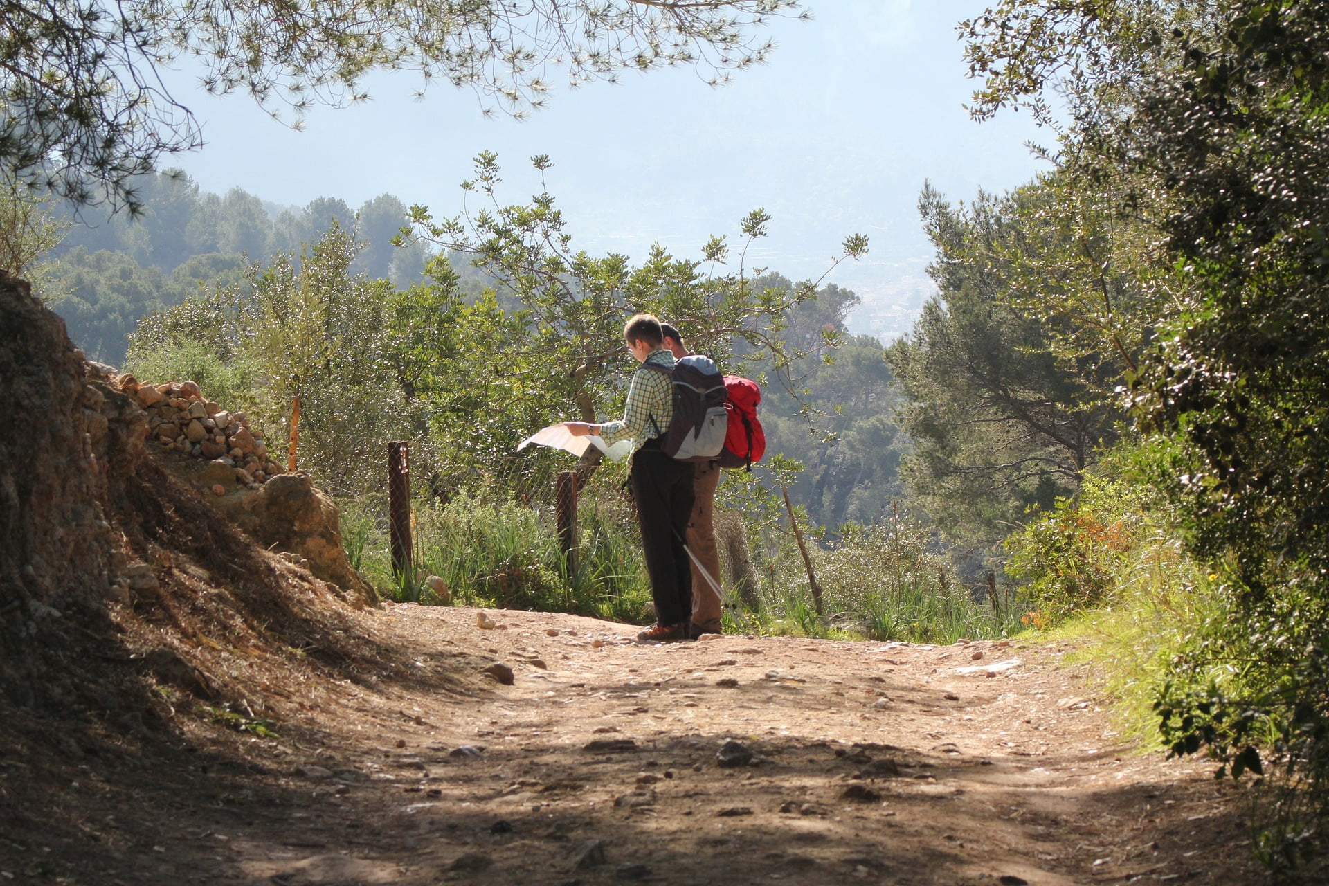
Bushwalkers need accurate, up-to-date maps. Whether planning or leading a club walk, or walking with a few friends in the bush, good maps enable walkers to safely navigate their intended route. They also open new possibilities during planning and when out on the track. So, where are these good maps found?

Paper or digital?

Using both is best. The paper map provides the 'big picture', can be annotated during planning and is 'weather proof'. A mapping GPS or Smartphone will, at the very least, provide an accurate position. Put both together and you have a well equipped walker who is unlikely to be mislaid. Both paper and digital maps are discussed below.

A word about scales

Large scale maps are a must: a good scale is 1:25,000, i.e. 4cm on the map = 1km on the ground. 1:50,000 (2cm = 1km ) is borderline, sometimes lacking sufficient detail for walkers, while 1:100,000 (1cm = 1km) is really only a detailed road map.

Some Smartphone apps

There are a large number of mapping apps, many linked to websites. For bushwalking, maps should be saved offline into the Smartphone itself, rather than continually accessing the internet via a mobile signal. Here are just a few free apps.

Avenza maps is linked to a map store containing over a million maps worldwide. It can also display custom maps from other sources and is used by many mapping organisations. You can use your phone's built-in GPS to track your location on any map, plot tracks, add photos and much more.

Maps.me is your worldwide street directory with lots of additional information.

Terra Map is a good, easy app for plotting your track on a walk.

Many navigation apps allow a free trial period before requiring a paid subscription to open up many features that are useful to bushwalkers. These include the ability to download maps for offline use, the ability to print maps and access to a library of maps and air photos.

Map sources

Vicmap

Vicmap is the Victorian Government mapping agency. It is part of the Department of Environment, Land, Water and Planning. It produces over 10,000 separate map sheets, using 3 scales, covering the entire state. These are:

Vicmap Topographic 1:25,000, A0 sheet

Vicmap Topographic 1:30,000, A4 sheet

Vicmap Topographic 1:30,000, A3 sheet
(1:30,000 maps contain the same detail as 1:25,000, but are designed for easy printing on A4 or A3)

Vicmap Topographic 1:50,000, A0 sheet

Vicmap Topographic 1:100,000, A0 sheet

These maps are updated every 18 months to two years.

The maps are available either online or via the Vicmap Viewer Smartphone app. This app allows you to purchase, download, store and copy Vicmaps to the Avenza map app. As only 3 custom maps (including Vicmaps) can be loaded into the Avenza free version at any time, the Vicmap Viewer app is handy storage for the maps. As all the map files are PDF’s, you can print any map you want; the 1:30,000 maps are especially handy here.

Vicmap prints only the 1:50,000 maps and 1:25,000 Specials. These paper maps are available through map resellers and outdoors shops.

If a large number of Vicmaps are required, they can be purchased through a value added reseller. Memory-map is one such reseller that stocks all Vicmaps. There are limitations: you must use memory-map software for viewing and printing the maps, but the cost savings can be considerable. Memory-map works on both your desktop and through a Smartphone app. Maps are downloaded as you need them or can be fully downloaded from the memory-map digital map store. Vicmaps are also available in some paid apps e.g. Gaia GPS Premium.

Third-party maps which utilize Vicmap data

Vicmap spatial data is freely available to map producers to make their own maps. nswtopo and Getlost Maps make 1:25,000 maps covering Victoria which are published in the Avenza app Map Store. nswtopo maps use similar symbology to Vicmap and make a small charge. Getlost maps use a slightly different symbology, are free, and contain additional data from other sources, e.g. OpenStreetMap. These maps can also be downloaded from the Getlost Maps website in a printable form if a paper copy is desired.

Spatial Vision

A number of areas of interest to walkers are covered by Spatial Vision’s Outdoor recreation guides. Most of these maps are at a scale of 1:50,000 and are packed with detail. Wilsons Promontory, The Grampians and Bogong Alpine area are a few examples. The maps can be purchased as paper, and are also available in a georeferenced form through the Avenza app map shop. Spatial Vision no longer prints or directly sells its maps. The remaining stocks of paper maps are available through map resellers who may be able to provide copies of out of print maps for you.

Meridian

Popular walking locations, such as the Brisbane Ranges, Lerderderg and Werribee Georges, Hattah-Kulkyne, Mornington Peninsula, Dandenong Ranges and others are covered by Meridian’s Walking and Park Maps. The maps can be purchased as paper or are also available in a georeferenced form through the Avenza app map shop.

OpenStreetMap

OpenStreetMap is a free editable map of the world maintained by over two million volunteers. These maps form the basis of the maps used in many Smartphone mapping apps. Many areas are mapped in great detail, including the accurate plotting of walking tracks. Occasionally, one may come across a remote area where the mapping is incomplete. Printing of these maps can be done through a number of websites. Inkatlas is one such site which is free, easy to use and you can add your own track plots too. It can print in black/white and A4 multipage so expensive printing is not required.

Cartography Community Mapping

CCM provides large scale topographic maps of areas around central Victoria, particularly Castlemaine. Scaled at 1:10,000 to 1:20,000, the maps are produced for bushwalkers and show walking tracks, access roads, vegetation, contours, and features of interest. They are free and provided as pdf files for printing (mainly on A3 paper), as KMZ files for Garmin GPS devices and as Geotiff for use in Avenza.

Melway

This much loved street directory does show minor roads and some walking tracks. In some areas the tracks are incomplete or inaccurately marked. There is also an online version.

Parks Victoria

Parks Vic visitor guides (Parknotes) often contain good information on visitor facilities, walks and a good sketch map of the park. Unfortunately, only some of these are currently available through the Parks Vic website. However, many of the maps are available in a georeferenced form through the Avenza app map shop for free.

Rooftop and Hayman maps

These maps can be only obtained through map resellers and outdoors shops - see list below. The Forest Activities Map series are the ones for walkers, at a scale of 1:50,000, with more detailed insert maps of some areas. They cover some popular walking areas such as the Cathedral Ranges, Marysville district and Victorian Alpine areas.

Google and Apple maps

These online maps are primarily road maps but do show some tracks in some areas. Both are available as apps for a Smartphone and Google maps are readily opened on a desktop.

Google Earth

Don’t forget this superb resource. Once you have decided on your walk route, you can visualise it on Google Earth. Check out every twist and turn you intend to walk. If you don’t have the program on your desktop or smartphone, you can use the web version.

Local Organisations

Don’t forget local organisations. Councils, alpine resort managements etc often produce excellent maps and track notes of walks in their areas.

Walkers requiring maps of areas adjoining Victoria’s borders (e.g. Kosciuszko National Park) can source them from interstate bodies or seek help from local Map Distributors and Outdoors shops. Distributers are able to print some map series on demand.

Map Distributers and Resellers

ABC Maps – shop and online. Maps printed on demand.

Maps, Books and Travel Guides – shop and online. Maps printed on demand.

MapWorks – shop and online

The above list is not exhaustive, but can start you on the way to finding quality, up-to-date maps for your bushwalks.

Links and sources accurate as at 20 May 2022. Link validity and link content are subject to change.

This information provided by Andrew Robinson

Posted on

Walking the Australian Alps Walking Track in Winter

Walking the Australian Alps Walking Track in Winter

Well done Mark and Andy Oates!

Brothers, Mark and Andy Oates are both members of our Bush Search and Rescue (BSAR) Team and their story of how they set out in the middle of the 2018 winter to complete the 660km, south to north, winter traverse of the Australian Alps Walking Track (AAWT) can be found here – it filled with beautiful images and a fantastic account of their adventure. 

Posted on

Bushwalking for Fun, Fitness, Friendship and Nature!

Retiring soon? Consider bushwalking as a way to stay fit, get outdoors and socialise!

At last, you have the time to make your dreams of leisure a reality …

You have retired! 

Or at least have reduced your working hours. 

You most likely have this on your wishlist:

To get fitter or maintain your fitness,

To get outdoors more – commune with nature, as they say in the classics,

To socialise more, meet new people and make lasting friendships,

To spend quality time with your spouse or showing your grandchildren the bush,

You cannot, no you must not be stuck at home, looking for a new weed to pull from the garden!

YOU NEED TO GO BUSHWALKING!

Most of us look forward to retirement with so much anticipation, but once the dust has settled:

  • You have been on that trip, and there will be more travels, but not next week.
  • You have, at last, put the regimen of working life behind you, swept away the former routines, and finally grasped the concept that work, paid or voluntary, is now optional, not compulsory.
  • You have caught up on all those jobs around the house that have been deferred for as long as you can remember.

YOU NEED TO GO BUSHWALKING!

Retirement can bring on many challenges such as:

  • Adjusting to a change in the pace of life;
  • Settling into your new lifestyle, new routines;
  • Coming to terms with your changed financial position, and for many,
  • Downsizing from the family home and moving to a new neighbourhood;
  • Moving to be near family, more childminding.

Some retirees find it hard to imagine how they had time to go to work while others find time weighing heavily. Many retirees speak of feeling lost and disconnected or socially isolated.  Few retirees will spend their golden years cruising the seven seas, living the life of the eternal grey nomad or find the meaning of life managing their personal superannuation fund.

Everybody needs and wants to find their correct balance between satisfying, meaningful activity and leisure. 

YOU NEED TO GO BUSHWALKING!

Eventually, the years move on and the physical realities of aging cannot be swept under the carpet any more. To keep the aches and pains to a minimum, to help medication do its job and reduce the risk of all the ‘modern’ epidemics, all advice leads to staying socially connected and physically active.

BUSHWALKING TICKS ALL THE BOXES – Fun, fitness, friendship, well-being and nature!

So let’s look at the amazing opportunities of having time on your hands and the world at your feet:  

  • Bushwalking is a fantastic way to meet like-minded people, make new friends and to keep in touch with old friends. For families, it is a great multigenerational activity to enjoy together, to share in the wonders of nature and to learn or pass on knowledge of the natural world.
  • Here in Victoria, we are blessed with ample opportunities and a variety of terrains in which to explore.
    • Close to Melbourne, near to regional cities or towns, one hour from home near public transport or two hours drive out in the countryside, and if you are so inclined, at more remote destinations.
    • There are Council Parks, State Parks and Forests, National Parks and popular recreational areas.
    • A choice of short, medium or long walks;
    • Every grading of walk from easy through to challenging, catering to every level of fitness and ability;
  • Bushwalking does not require expensive membership fees or elaborate equipment.  It is something that can be enjoyed as a member of a club or group or in a casual get together with friends. Best practice is not to go onto less travelled tracks on your own.

VISIT A BUSHWALKING CLUB

Most bushwalking clubs will allow you to join them as a guest (usually for up to three walks), that way you can get a feel for the club and its members and what recreation it can provide for you, before you commit. You can explore our affiliated bushwalking clubs here. Many clubs arrange interstate and international walks, so there are many options for you to spread your wings. 

Click on this link to see how Bushwalking could be your gateway to safe outdoor recreation!

All Images courtesy of Melton Bushwalkers, one of our affiliated bushwalking clubs.

Posted on

Gift Ideas for Bushwalkers

Busy with your Santa list?

SantaHat_Backpacker

Apart from the usual wishlist for new boots, backpacks, clothes and tents, here are some other gift ideas and stocking fillers for bushwalkers:

Wishing you a blessed festive season and plenty of amazing bushwalks! 

Posted on

Injured or Ill in a Remote Area?

PARAMEDICS GO BUSH WITH AMBULANCE VICTORIA'S NEW REMOTE AREA RESPONSE

Demo_at_BWV_Leadership_Forum

The last few years have seen Ambulance Victoria up-skilling specialist paramedics across the state for responding into remote and wilderness environments. Wilderness Response Paramedics are trained to assist in medical emergencies in Victoria’s bush and alpine areas and can provide patient care over protracted periods in challenging locations. We had the privilege of being introduced to this service by Andy Oates (paramedic with Ambulance Victoria) and volunteer with our Bush Search and Rescue (BSAR) team (photo above) at the recent Bushwalking Victoria Leadership Forum. 

They respond as part of a multi-agency team which typically sees members from Victoria Police (VicPol), Victoria State Emergency Service (SES), County Fire Authority (CFA), or the Department of Land, Environment, Water, and Planning (DELWP) co-respond.

The team is able to access areas that are otherwise inaccessible. Wilderness Response Paramedics then assess and manage a patient until extrication can be arranged either by ground or air.

This month (June 2019) saw the rollout of this service extended to a group of paramedics working in the metropolitan region. There are now more than 90 trained responders throughout the Victoria. A number of the paramedics involved in the program have a BSAR background. Note that VicPol is the ‘Lead Agency’ in any Search and Rescue incident in Victoria and that the new Ambulance Victoria program is aimed at giving its paramedics the capacity to safely provide a high level of medical support for an injured or ill patient once located. Here is a training video. 

More information about Ambulance Victoria Services here

Bushwalkers are most grateful for this service in the unlikely event of an incident whilst on a remote bushwalk - thank you Ambulance Victoria!

Posted on

Are You a Gliker?

Woman athlete fit girl wearing warm sporty clothes outdoor in cold weather drinking hot tea from vacuum flask thermos warming up. Sports activities hiking in winter or autumn time

Fancy the idea of a bushwalk, but not the oh so practical attire? Chances are that you are a Gliker (glamorous + hiker). Here are three ways to be practical and a little bit glamorous when bushwalking:

Colourful accessories

Who said earthy colours are a must, it's not like we are trying to camouflage ourselves from predators! Wear a bright hat, scarf, gloves, belt, socks or sweatband to match your mood and style. Ladies can match this with a good SPF lipstick to protect against the sun and dryness. 

Hiking boots

Previously frowned upon in fashion circles, it has now become a fashion statement as you can see here. You do need good and comfortable shoes to navigate terrain and protect your feet, but hiking boots have come along way! They come in many materials, colours and styles, so do consult a good buying guide and go shopping.

Backpacks

You no longer have to look or feel like a pack donkey, there are so many sizes and styles of backpacks to choose from as you can see here.  They take load, posture, body size and many other factors into consideration, so you may end up taking your hiking backpack to work and start a new trend!

Want to do some gliking and glamping? Have a look at this guide for the best gliking destinations around the world as well as glamping spots in Victoria - you can even do an urban hike if you do not have the time to go bush.

Posted on

Paper Maps for Bushwalking

How to print a paper bushwalking map from an electronic version

adventure-blur-cartography-408503

Over recent years, many map producers have provided their map collections in electronic form. Only a limited number of these maps are available in a printed form. Geoscience Australia ceased printing its 1:250,000 topographical maps late in 2019. This is not a major problem for bushwalkers in Victoria: 1;250,000 (1cm to 2.5km) is not a scale most walkers use, because these maps provide insufficient detailGood detailed maps covering Victoria at 1:25,000 (1cm to 250m) and 1:50,000 (1cm to 500m) are available in electronic form and many are also available as paper maps. These scales are far more useful out on the track.

Paper maps can be purchased from suppliers such as Vicmap (mainly 1:50,000), Spatial Vision and Meridian – see Finding Maps for Walking in Victoria for a detailed list of sources, including shopfront and online suppliers.

If, rather than purchasing a paper map, you want to print one of the many electronic maps which are available from a variety of sources (including any of the Geoscience 1:250,000 maps) it’s relatively easy.

Many maps are produced in geopdf format. This allows the maps to be displayed and used in navigation software and apps e.g. Avenza. It also allows them to be easily printed to the correct scale using free software e.g. Adobe Acrobat reader. A walk leader can use an electronic map for navigation with their smartphone and carry the identical paper map.

Here are some options if you wish to have a printed copy of a geopdf map – either a whole map or part thereof.

Print the whole map

  1. Take the geopdf file to your local printer. It will cost about $20 for an A1 sheet and a little more if you want it on more robust waterproof paper, OR
  2. Print the map as smaller tiles and stick them together. You can do this at home, using Adobe Acrobat reader. Open the required map, press ‘Print’ then press the ‘Poster’ button. Ensure ‘Tile Scale’ is on 100% and ‘Overlap’ is set at 1cm. ‘Cut marks’ should be checked to make putting the tiles together easier.

The preview screen will show how the map image will be tiled. Press print. Trim/assemble the sheets.

Paper_Maps

Print part of the map

Open the map in Acrobat reader. Click on the ‘Edit’ menu and then ‘Take a Snapshot’. Highlight the desired area and press print. Press ‘Size’ and ensure ‘Actual size’ is checked. Your selected area will be shown in the middle of a sheet. If your selected area is larger than one sheet, you can poster print in tiles as described above.

What to do if you don’t have a colour printer

Most modern computers can make a pdf file through the Print interface. Instead of printing to a physical machine, you can make a pdf file instead. Use the above instructions and just change the setting under ‘Printer’ to the pdf driver.

You can change the paper size to A3 under ‘Properties’ if you have a larger area to cover, or want bigger map tiles. Place the saved pdf file on a USB thumb drive and take it to your local self serve colour photocopier/printer.

Paper_Maps2

Poster printing is a quick and cheap way to produce reasonable-quality larger maps from geopdf’s. You can use waterproof paper too, if you wish: ‘Rite in the rain 8512’ paper can be used in a laser printer; it’s about 30 cents an A4 sheet.

When printing from electronic maps, please remember to respect copyright. Personal use only.

Author: Andrew Robinson

Date: 06 August 2020

Posted on

Correct Track Notes and Maps for Bushwalkers are Essential

So you're going on a bushwalk - do you know the true track conditions or are you heading out into the great unknown?

Brad_Lester_cartoon_1

When is a track not a track? When it is a creek ...

  • Have you checked the weather forecast for the area?
  • Do you understand how quickly weather conditions can change in the area, especially in the High Country?
  • What are the current track and access conditions?
  • Will you be checking with someone who knows or has recently been there?
  • Have you had a look for updates on the Parks Victoria website or if possible, speak to the land manager or park ranger? 
  • Have you been to the area before?

When is a track not the track? When it's the wrong track or it's not a track...

  • Can you read a map?
  • Do you have a decent and recent map of the area? (Here is a good guide on where to source maps)
  • Do you have adequate navigation skills for the walk?
  • Are you able to follow a faint track or stay on an unmarked “route only” and not wander off into a scrubby gully?
  • Are you respectful of the environment by not walking off track? 

Answered NO to the above? You should be going out there with a Bushwalking Club!

Club walk leaders:

  • Are trained to plan and successfully lead walks,
  • Will mentor inexperienced walkers,
  • Guide aspiring walk leaders into being capable and confident leaders, and, best of all
  • Will get you back to civilisation.

A club walk leader will have done all the planning for you, so you can:

  • Walk with confidence,
  • Enjoy on the scenery,
  • Socialise,
  • Experience the pure enjoyment of being out there in the bush, and
  • Forget time - as the club leader knows where the group should be and when they should be there.

Bushwalking Clubs have a wealth of experience in their membership which club leaders draw on when planning walks. So you will receive the benefit of all that experience.

Want to answer YES to all the above? A Bushwalking Club ticks all the boxes!

  • It is inexpensive. Annual Membership of a club is on average between $50-$100 a year and you can go on as many walks as you like!
  • Clubs often have a bushwalking/camping gear for hire/loan to members, so you don't have to buy lots of stuff.
  • Enjoy the companionship, and the pleasure of being with like-minded people;
  • Relax in the safety of a group,
    • Be rescued if you accidentally walk into an irate wombat’s burrow,
    • Be missed if you inadvertently disappear into a ferocious Bunyip’s den.
    • First Aid - there will probably one or more people on the trip who have First Aid qualifications.
  • Meet new people, some may even become close friends!

Please do not go out into the bush on your own, even very confident and experienced walkers can become disorientated in weather changes or sprain an ankle and be unable to walk further!

Be prepared – enjoy the bush- and easiest of all - join a club!