Little Desert National Park & Mt Arapiles Map Guide, 1st Edition and Victoria’s Deserts 4WD Touring Map, 5th Edition
The popular Victoria’s Deserts 4WD Touring Map, now in its 5th edition, is a ‘must’ when planning a trip to the beautiful deserts of Victoria. Released in August 2020, this is the map I’d spread out on the table to research everything this area offers. The main map at 1:350,000 (that’s about 3mm representing each km) is essentially a road map; it extends from the Murray south past Horsham and west across the border into South Australia. It is packed with up-to-date detail on roads, tracks and camping sites and it also highlights tourist activities such as the Silo Art Trail. There is even a list of recommended reading for visitors to the region.On the reverse side of this large map are enlargements of seven popular areas, including Wyperfeld and Little Desert National Parks, Pink Lakes, Mt Arapiles and the northern Mallee. Scales of 1:100,000 (10mm per km) to 1:175,000 (about 6mm per km) are generally used; most walkers would find larger scales more helpful, although one could navigate from the enlargements at a pinch. Relief shading is used to illustrate topography, but, except for the Mt Arapiles map (1:50,000), no contours are shown – understandable on medium-scale maps of a relatively flat desert region. The grid is in Latitude/Longitude, which could be a challenge for those who use MGA grid references. These enlargements are also packed with clear, easy-to-read detail relevant to any visitor.
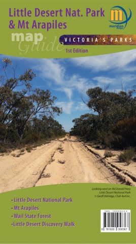
If the Little Desert, Mt Arapiles and the Wail State Forest are your areas of specific interest, then the new, smaller format Little Desert National Park & Mt Arapiles Map Guide is for you. Whilst essentially offering the same level of detail as the Victoria’s Deserts enlargements, these maps have slightly larger scales; the Mt Arapiles section is well-detailed at 1:20,000 and includes contours. These maps will interest walkers, as they show walking tracks in addition to vehicular tracks and roads. Again, lots of visitor information is included.
All of these maps are also available in georeferenced electronic form through the phone app Avenza. Once your trip planning’s completed using the paper map, you can hit the track with the electronic version. The GPS capability of the phone means you always know exactly where you are. This is the beauty of having the maps available both as paper and on a phone app which has full navigational ability. Interestingly, the electronic Little Desert map has an MGA-UTM grid overlayed, unlike the paper version.
As there are few maps of these fascinating areas, these publications would be an invaluable tool for those planning an adventure in this region post-COVID. As a bushwalker, when I’m on the track I prefer to use a large-scale map with contours and some indication of vegetation cover and other topographic features. However, for a touring or camping trip, I’d definitely use these paper maps for planning – this is where the Victoria’s Deserts maps really come into their own.
Andrew Robinson
(Bushwalker, Camper, Mapping and Navigation trainer)


 Press release