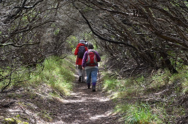
Most bushwalkers recognize that Victoria’s natural areas are a valuable and fragile resource. ‘Tread Softly’ has become embedded in the bushwalker’s code: we understand the importance of low-impact walking and the need to conserve and protect our favourite places.
We can become even more environmentally sustainable walkers by adopting new habits and continually making low-impact choices – when choosing a walk and outdoor clothing; when choosing, purchasing and packaging food; when choosing where to pitch a tent; by practising the three R’s – Reduce, Reuse, Recycle.
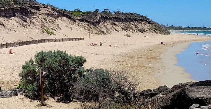
Lots of walkers (and their dogs) love Queenscliff. Public feedback is being sought on how erosion at Dog Beach should be managed. If you’d like to contribute, here’s a link to Engage Victoria’s Dog Beach Coastal Adaptation Plan. Submissions close 10 July.
Community feedback is influencing the location and design of the Great Ocean Road Coastal Trail, which would link the Surf Coast Walk to the Great Ocean Walk. Existing tracks will be utilised where possible. Public consultation closed on 27 June, but you can learn more about the trail alignment, its new suspension bridges and the cultural heritage and natural values of the area here.
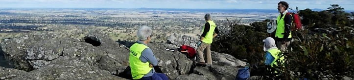
Bushwalking Victoria representatives were extremely pleased to welcome members to the annual Leadership Forum & AGM on 18 June. It was wonderful to meet face to face after two years of enforced Zoom activities.
The 43 participants included representatives of 23 member clubs, along with six individual members. All contributed to a day of networking, sharing of ideas and discussion on issues facing our organisation and its members.
President Mike Grant opened proceedings with an update of BWV activities throughout the year and acknowledgement of all the volunteers who support Bushwalking Victoria, its members and the wider bushwalking community.
The Keynote speaker was Matt Ruchel from the Victorian National Parks Association (VNPA), which is celebrating 70 years of service. Matt provided an informative and interesting update on current conservation issues in Victoria, focussing on the threat to protected areas, threatened species and other wildlife caused by development and logging activities in our parks.
Conveners of our Bush Search & Rescue and Bushwalking Tracks & Conservation volunteer teams provided an update on their valuable activities. The program also included interactive workshops, with participants encouraged to join in discussions on three key areas:
Safety and Risk – working through issues which affect club safety practices
Club Development – how to attract and retain members, develop leaders and support committees
Engagement in Conservation – using the online consultation platform Engage Victoria to keep abreast of planned developments that could impact bushwalking activities.
After lunch, an open forum allowed members to raise issues for discussion. These included: succession planning and getting involved with BWV; the Falls to Hotham Alpine Crossing project; Covid-19; dual club memberships; who pays for helicopter rescues; and future hosting of the Federation Walks event.
The day concluded with the Bushwalking Victoria AGM. The Annual Report was presented to members and a new Board elected. A number of Board members are continuing their service and one new member has joined the team. The Board looks forward to continuing to support our bushwalking community during the coming year.
If you would like to find out more about joining Bushwalking Victoria as a member club, or getting involved with our volunteers, please contact us at admin@bushwalkingvictoria.org.au
Engage Victoria is the Victorian Government’s online consultation platform. You can join the conversation on Wilsons Promontory Revitalisation to protect the Prom’s unique environment and biodiversity, and to shape visitor experiences for future generations. Consultation closes 15 May.
When completed, the new Murray River Adventure Trail – a long-distance walking, cycling and water-based trail – will stretch from Lake Hume to Mildura. The State Government has invested $10.3 million. Parks Victoria will undertake cultural heritage and environmental assessments. The initial section of the project is expected to be completed in 2024.
Citizen science plays a critical role in protecting threatened species, including through the Conservation Regulator’s Forest Protection Survey Program. This program protects animals, plants and habitats that are threatened or of high conservation value in areas of state forest that are scheduled to be harvested.
Parks Victoria is challenging walkers to explore 18 lesser-known parks with their ‘Your Autumn Unseen Places Nature Challenge’. With each visit, you can enter a prize draw to win a nature experience. This promotion closes 31 May.
The new Trail Hiking Australia website has been launched. It will appeal to all outdoor adventurers, featuring over 3,200 trails across Australia to hike, walk, run or ride.
The Victorian Government has released a new feature on the Get Active Victoria website to assist Victorians to find places close to home where they can exercise – Places | Get Active Victoria. There are more than 500 trails, parks, exercise stations and playgrounds listed.
Images: Engage Victoria; Forest Protection Survey Program; Parks Victoria; Get Active Victoria
Bushwalking Victoria’s popular Federation Walks event finally came to fruition in Licola on 25-28 March. It was an overwhelming success, with over 200 participants enjoying a wonderful weekend of walks in perfect weather in this remote part of Gippsland. Originally planned for November 2020, the event had to be rescheduled twice due to COVID restrictions.
Participants from 32 member clubs selected from a smorgasbord of walks, with the ‘classics’ – the Crinoline, Kellys Hut, Mt Howitt and Bryces Gorge – proving popular. Special overnight walks included Lake Tali Karng, Wonnangatta Valley and Bryces Gorge, with the Macalister 4WD club assisting with logistics support. An experienced team of activity leaders guided the groups and shared their local knowledge of the area.
Mike Dower, Area Chief Ranger, welcomed participants to Gippsland’s Foothills and Southern Alps, and Councillor Carmel Ripper welcomed walkers to the Wellington Shire on Friday evening. Entertainment was provided by guest speaker Beau Miles, a Gippsland local, on Saturday evening and by local singer Courtney Jane on Sunday afternoon. The Licola Lions Village accommodated all attendees and provided excellent facilities in a spectacular location.
A wonderful time was enjoyed by all. Praise goes to the organising committee, members of the Ben Cruachan and Strzelecki clubs, for their diligence and persistence in delivering a successful event. Thanks also to the Wellington Shire for their generous support.
We were happy to welcome two visitors to the September Board meeting: Merilyn Liddell (Melbourne University & Alumni Bushwalkers) and Trevor Rosen(Melbourne Walking Club). Although many Board members have only met on Zoom, we’re working well as a team to support and represent Victoria’s bushwalkers.
Of the numerous issues discussed, the following might interest you:
COVID-safe plans for clubs: the President, Mike Grant, has recently spoken with many clubs regarding their questions and concerns about group sizes on walks and at meetings, whether walkers should be required to be double-vaccinated and whether walkers should car-pool.As current restrictions change regularly and are different for Melbourne and the regions, it seems unwise for BWV to develop its own COVID-safe plan for clubs to access. Our advice is that clubs adhere to the density limits proscribed by the managers of their meeting venues and, above all, refer to the publically-available material on the State Government website.Over coming weeks, the advice from the State Government regarding requirements for recreational groups will become clearer.
Mountain Bike Trails: Whilst many bushwalkers are also mountain bike riders, we’d all agree that the safety of walkers in the bush and the conservation of ecosystems and natural landscapes are vital. Complaints about the joint use of tracks is common, as is concern about environmental and heritage site damage. Bushwalking Tracks and Conservation (BTAC) is working on a position statement on Mountain Bike Trails; once complete, it will be sent to clubs for feedback.
New Individual Supporter Members: Eight new members joined our association this month. Welcome aboard! Anniversary of the formation of the Federation of Victorian Walking Clubs with BWV members, old and new, in 2024. We look forward to celebrating the 90th.
Risk Management: Risk assessment and mitigation is high on the “Help!” list of many clubs. A new BWV working group has been established: as well as researching legislative requirements, the group hopes to gain a better understanding of what guidance clubs want from BWV. They will also investigate what happens with club incident reports and analyse incident and injury trends.
International Women’s Day focus on women-only bushwalking clubs
We have three member clubs who are women-only bushwalking clubs and many women are members of our other 59 member clubs as well and we are celebrating each one of you today!
The main photo is of Suzie Hale, president of The Victorian Mountain Tramping Club (VMTC) who did a solo trip of the 4,280km Pacific Crest Trail which she completed in 153 days last year. Other major accomplishments on her impressive walking CV include leading a VMTC group who completed the Australian Alpine Walking Track in 42 days.
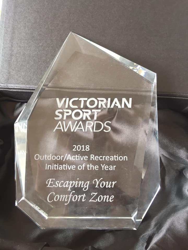
The first women-only bushwalking club we would like to introduce you to is Escaping Your Comfort Zone. Not only are they trailblazers in many ways, they have just won a Victorian Sports Award for the Outdoor/Active Recreation Initiative of the year!
Loey Matthews, Volunteer Walk Leader for Escaping Your Comfort Zone, shared this about their club:
If you’ve never been on one of our hikes before, you might wonder what makes Escaping Your Comfort Zone (EYCZ) different from other bushwalking clubs, and what “body positive” hiking is all about anyway? Let’s break down what drives us, and what you can expect at a body positive hike that’s different from other hiking groups.
Escaping Your Comfort Zone
What is body positivity?
Body positivity is a tricky concept to define, but there are some things that we can all agree on.
We live in a society where there is immense pressure to conform to a certain size, shape, and have other physical characteristics that are considered “good looking”. When people don’t fit that size or shape, it is expected that we should diet and exercise, and use makeup, hair product and even surgery until we do fit that expectation.
Body positivity comes out of the fat acceptance movement, and aims to help people overcome dissatisfaction with their bodies, so they can lead happier and more productive lives. At Escaping Your Comfort Zone, we are all about accepting that our bodies are unique and realistic, and furthermore, they are amazing and powerful just the way they are.
We want to throw out the guilt of “good” and “bad” food, throw diet talk in the bin, and take away any obligation that you might feel from “having” to get active.
We want our members, and everyone else, to know that we are not broken, our bodies are enough. They are whole, and powerful and capable of amazing things. We are not a project to be fixed. We accept you all as you are.
The outdoors doesn’t care what you look like, and neither do we!
So what is different about body positive hiking?
We aim to be an open group for every woman and gender diverse person who wants to get outdoors but doesn’t know where to start. Many groups are fantastic places for people who are already hiking or having outdoor adventures regularly to meet each other, but we aim to be a starting point.
The majority of our hikes are beginner friendly, and usually take between 1.5 hours to 2.5 hours to complete. We don’t focus on how many kilometres you’ve done, because more often than not, our hikers are capable of much more than they think!
We always go at the pace of the slowest hiker, and there is never any rush to the finish on one of our hikes. We expect and plan for lots of stops along the way, to take selfies and point out the mushrooms and animals we meet along the trail. I’ve heard from some of our members that when they’ve been on hikes with other groups, the hike was promoted with the expectation that they would support the slowest hiker, but found themselves rushed along. At EYCZ we take the need to support everyone at their own pace really seriously – you’ll find a leader at the rear of each of our hikes, chatting to the person who is taking their time.
We enjoy the experience of being outdoors, caring for our physical and mental health through reconnecting with the natural world. It means we build friendships with people we would never have met otherwise – one of the things I cherish most is the diversity of age in our group, and the ability to connect with people way outside my normal social ‘bubble’.
Escaping Your Comfort Zone hikes want you to feel that no matter your size, skin colour, where you were born, your religion, your favourite song to dance to, who you’re attracted to, your disability or anything else, your body will never be seen by us as a problem to solve, but rather as an individual person who is on your own journey and wants to have adventures along the way.
They hike multiple times a week all over Melbourne, Geelong and beyond, and also have groups in Gippsland, Canberra and Sydney. You can get all the details at www.escapingyourcomfortzone.com. Or find them on Facebook @escapingyourcomfortzone or Instagram @escapingyorucomfortzone
The Melbourne Women’s Walking Club is an active club for women walkers of all ages and includes both metropolitan and country members. Their program covers a wide range of activities, however the club’s primary focus is bushwalking with walks of various types, gradings and distances frequently scheduled.
These activities include daywalks, backpacking, base camping and accommodation trips. Members can also participate in urban walks, cycling, canoeing and conservation work. They have regular social gatherings throughout the year and a training program in bushwalking skills.
You are welcome to join the club as a guest on one of their walks if you would like to give bushwalking a go! Contact Jane Matthews here.
The idea for the women only club was mooted at a large Girl Guide Camp. Many of the leaders were bemoaning the fact that they had no like-minded women to walk with. Consequently the club was formed, a walk planned and a cake made! Many of their foundation members are active in the Girl Guides but membership extends to all women who love walking, talking, laughing and dare we say it, eating!
Members come from all over Victoria, communicate and plan by email only and meet for the Annual General Meeting each June. At this meeting, walks are decided, leaders volunteer their services and decisions are generally decided by consensus.
Their annual itinerary of walks includes monthly walks, which often are walks from a weekend base. Twilight walks, pack carries, interstate and overseas walking trips are also included throughout the year. Each year a ballot is conducted for the best walk of the year and ‘Ned’, a replica of their mascot is awarded to the leader of this walk. Ned hitches a ride on each walk.
Overseas trips have included trekking in Sapa, Vietnam, and hiking from the source of the Thames to the sea along the Thames Path. This was not as everyone suggested a lengthy pub crawl, but an historical and educational ramble! The Bushrangers Womens’ Walking Club Inc goes from strength to strength each year with a growing membership of women who love the bush. The can be contacted here.
Exploring the Mysterious North East Corner of the Prom
Members of the Bayside Bushwalking Club took a walk on the wild side in March 2020, exploring the north-east corner of the Prom. Written by Paul Redmond.
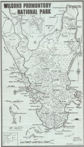
The official ‘Park Notes’ for the Northern Section of Wilsons Promontory are quite discouraging. Walks’ Reports posted on the internet are not all that encouraging either.
This unlikely wilderness sits over there, across the flat country, to the east of the bitumen road to Tidal River. It beckons and tries to tempt the bushwalker with an inaudible siren call, “Turn your car into Five Mile Road and abandon that walk planned to commence at Telegraph Saddle”. We barely notice the grey/blue hills to the east. Your itinerant bushwalker remains aloof and never visits this mysterious north-east corner of the Prom.
Now, at long last, I have seen it first-hand and it is good.
The Northern Circuit is certainly not for the faint-hearted nor the unfit nor the unprepared. It is a hard walk done in long daily stages due to the distance between the relatively few campsites and the condition of the tracks. These remote camps are limited to six persons per night. There are limited assured water supplies and no Plan B optional routes. You are unlikely to meet anyone on the 60 km circuit. Some go clockwise others prefer the reverse. We went clockwise.
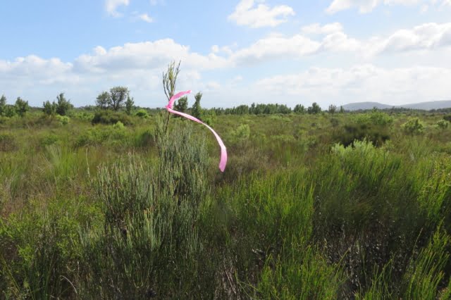
The majority of the circuit’s component tracks are overgrown and consequently hard to follow. You are pushing through dense scrub varying from knee-high to two metres and higher. There are numerous blind culs-de-sac caused by so many having gone astray at the same point, typically following a wombats’ runway, deviating around the prickles of Hakea or the points of a Xanthorrhoea or by just missing an unexpected right-angle turn. The tracks have more meanders than the Brisbane River. We lost the track quite often, but could quickly realise our error and recover, thanks mainly to the leader’s GPS or less technically, three pairs of eyes searching high and low for the elusive pink tapes that mark the true path of righteousness. These tapes vary from bright pink that contrasts clearly with the background, through to faded pale remnants that are hard to spot. New or old, they may be wrapped around a branch, high or low; flapping in the wind from a mere slip of a branch or tied to a juvenile trunk top that can barely support its own weight in the wind. You are never sure where to look.
The foot track, a narrow shallow groove in the ground, can be followed with care, but one cannot spend a whole trip staring at the ground. The scrub’s branches have grown over the track and they close ranks immediately behind the walker you are following, barely three metres in front. You can see where they are, but not how they got there. It was hard and tiring, constantly pushing through the scrub. Fortunately, most of the scrub we encountered had quite soft and flexible juvenile growth.
There is, however, plenty of resistant mature growth and hard deadwood with sharp broken ends to scratch an uncovered arm and sometimes draw blood on a covered arm with no damage to the protective sleeve. Compensating areas where the scrub is knee-high and not such hard work do exist, but even there the track can still be hard to follow. Being a wilderness area the signage is sparse; often old and faded.
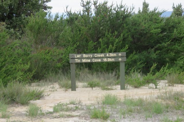
Track Marker – But Where is the Track?
Being a wilderness area the signage is sparse; often old and faded.
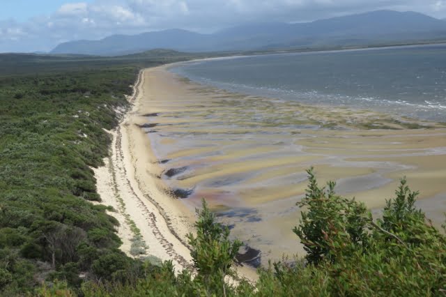
Chinamans Long Beach
Five Mile Road is a closed Management Road that crosses the Prom running almost due east from near the southern reach of Corner Inlet. It is a tacit dividing line between the north and south sections of the Park. It is the way into and the way out of this wilderness.
We departed the car park on Five Mile Road at 1:30. The undulating gravel surface of the road eased us into the start of this expedition. The expansive views of Corner Inlet to our north-west (left) were revealed afresh at the top of each rise. Always in view is the scrubby flat country to the north-east which contains Chinamans Swamp and its marshy environs.
The undulation of the scrublands is relieved by many clumps of trees and small rises and typical Prom rocky outcrops. Mount Vereker (638m) and Five Mile Peak (475m) stay in view at the southern edge of the wilderness. Roundback Hill (314m), Mount Margaret (219) and Mount Hunter (348m) run to the north-east in a distant line. Mount Singapore (145m) is just visible at the northern tip of what J. Ros Garnet refers to as the Singapore Peninsula in his ‘History of Wilsons Promontory’.
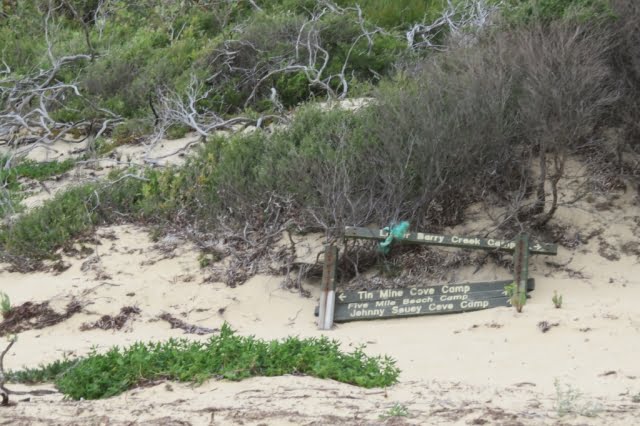
Descending a small rise, we see a green Parks’ sign planted in the sandy runoff beside the road, standing authoritatively in front of the dense scrub. It proclaims “Lower Barry Creek 4.3km” and “Tin Mine Cove 18.9km” with each notation accompanied by a broad arrow pointing to the sky. Good so far; but where is this sign-posted track. There is not even the slightest gap in that wall of scrub to indicate the track into the wilderness. After much examination of the area, eagle eyes recognised a change in the patterns in the sand revealing where to part the scrub and step through the curtain onto the track. Talk about “What’s behind the Green Door?”
And so we were into it. Not quite the great unknown, but if the entrance is a guide, who knows what this afternoon may bring.
The Track is Through There, …Somewhere
Two hours and twenty minutes (and 4.3 kms.) later, the party emerged from the scrub where the track crosses Barry Creek. A long stride across the leisurely flowing black tea coloured water, up the steep sandy bank and we were standing in the camp. When written down, the afternoon’s distance does not seem that much, but your author, for one, was very glad to reach the mysterious Lower Barry Creek Camp. I anticipated that this camp would be quite unlike the more familiar southern section camps that sprawl among the tea trees behind a beach. And it is; a small clearing hiding in the forest with just enough space to accommodate the regulation maximum of six walkers; in fewer tents.
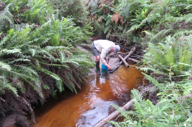
Dan collecting some ‘black tea’
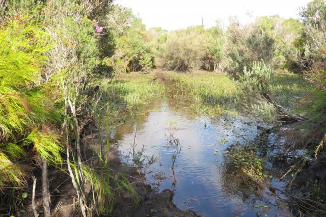
Mid-morning on day two saw us crossing the infamous Chinamans Swamp. We were lucky. Most of the swamp that we transited was just damp, squashy or even dry. The three recognisable water courses that crossed our appointed way were knee-deep in opaque muddy water that just hovered over an unseen, very soft and uneven bottom. It seemed as if we were walking along the creeks, not crossing them. No luxury of boardwalks in the wilderness.
It could have been worse. Horror stories of seemingly endless waist-deep swampy sections, are told by the intrepid who have passed through in wetter seasons. I was elated when I realised that we had just stepped up from our last quagmire. I exaggerate. It was more muddy water than watery mud, with green ribbon-like weed growing in the water and floating languidly on the surface.
Having passed through the swamp, there was about one and a half hours through the difficult scrub to the southern end of Chinamans Long Beach. From the rises on the track we were treated to expansive views of the huge saucer which is drained by Chinamans Creek and Barry Creek into Corner Inlet. Track conditions gradually improved as we approached the beach, as scrub gave way to tea tree and the track surface gradually became sandy, indicating that the beach (and lunch) was not far ahead.
A gusty wind on the beach sent us back into the shelter of the foreshore tea tree for lunch. Anthony discovered Warragul Greens growing at our picnic spot, but no one moved to supplement their rations. A four kilometre walk on the wave compacted sand to the northern end of Chinamans Long Beach brought us to a track to take us above the rocks and the headland and around Tin Mine Hill to the Tin Mine Cove camp. We arrived at the respectable hour of three o’clock or thereabouts; this seemed to satisfy our leader’s desire for punctuality.
We braved the cold sea for a brief swim at the Tin Mine Cove beach. We could have used a swim yesterday afternoon at Lower Barry Creek Camp after the warm first afternoon.
Chinamans Swamp
The tracks pass through many sylvan patches of Banksia forest. A pleasure to pass through, to admire the gnarled old trees with bark-like hard old blue-grey leather, all splits and knobs They are such a contrast to the adjacent younger slimmer saplings, branching out abundantly with new growth displaying fresh green leaves. It is not all doom and gloom. There are sections of track that are easy to follow with no thorny flora, passively waiting to attack the labouring bushwalker.
Fortunately, the hills are gentle. The track, for all its shortcomings, has no replications of the long climb up to Telegraph Saddle or the knee destroying climb up to the Lighthouse precinct past the concrete helipad.
There were two precipitous descents on to beaches. If you had chosen the counter clockwise circuit, they would be very hard going as your feet slipped and sank into the loose sandy soil; handholds proving to be unattached to the soil, despite the appearance of security.
The scrub bashing was offset by two long beach walks – Chinamans Long Beach on the western side and Three Mile Beach on the eastern side. Beach walking is seen by some as boring, but there is pleasure in walking on a gently undulating beach, more or less in a straight line, except when searching for harder sand. I concede that a beach that slopes steeply from foreshore to waters’ edge is a pain in the downhill knee. If you are ambushed by a silent rogue wave as you walk the hard sand near the water’s edge, lost in a beachcombing reverie, it is a serious pain in the bottom. The beach sections were such a pleasant relief to the hard work pushing through the inland scrub with eyes constantly on the lookout for the next pink track marker and wary for reptiles basking on open sunny sections of track.
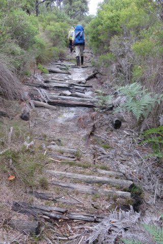
The track eastwards across the Prom, on day three, from Chinamans Long Beach to the lattice navigation light tower above Three Mile Beach was easy to follow for the most part. It had been cleared by Bushwalking Victoria volunteers about five years ago, but nature does not sit idle, another two to three years will see sections of the track all but disappear under the vigorous regrowth. Towards the middle of the crossing, a short length of the track is formed by an ancient corduroy surface. The logs forming the path are held in place by rusted steel cables secured to the logs by thin dog spikes. The substantial thick cables have deteriorated and parted from the logs whose charred ends showed that they had been burnt in a bushfire in years past. It is a relic of the bygone days when the track was formed for vehicles. Only a truck could have carried those cables to the site. Presumably, they were scavenged from the abandoned tin mine near Chinamans Beach (the short one north of Tin Mine Cove).
Day three included a brisk march along Three Mile Beach. Here, with their feet and trunks buried in the creamy coloured sand, the grey skeletons of large trees stand tall with an eerie starkness, against the green backdrop of the hills at the end of the beach. There are many reclining tree trunks lazing about, but they lack the gaunt starkness of the upright ghosts.
We lunched at the southern end of Three Mile Beach.
Three Mile Beach
Between Three Mile Beach and Johnny Souey Cove the track skirts around Three Mile Point which rises above the waves crashing in from the Southern Ocean onto the granite boulders with their coating of the endemic orange lichen. We discovered the hard way that there is more than one track around or indeed, over Three Mile Point. The main track which is clear and well defined eluded us as we fell to the temptation, after lunch, to take the first indication of a track. We followed some intermittent and elusive fading pink tags, heading uphill on an abandoned track which deteriorated to “route only”, a term I first saw on Duncan Brookes’ VMTC maps of walking areas in the High Country.
What remained of the track eventually disappeared from under our feet, leaving us pointed uphill and nowhere to go. The GPS would have told us, had it come equipped with a voice, that we should have walked a few metres further around the beach after lunch to where we would have easily picked up the cleared track – the track that did not climb high over the hill, but followed the contour around just above of the rocks and the waves.
To recover our position without retracing our steps, we compromised between blindly progressing over the hill towards Johnny Souey Cove and dropping directly towards the crashing waves. We did this by taking an oblique route down through the scrub towards our destination. This action slowly progressed our journey and brought us to the elusive well defined cleared track and the resultant increase in pace.
We ‘passed’ on an inspection of the Johnny Souey Cove campsite and pressed on in the luxury of a good cleared track over the divide separating the two bays. From our vantage point, we could see several runabout boats in the lee of Rabbit Island as well as between Monkey Point and Rabbit Rock.
As Anthony remarked, “No doubt those fishermen are looking up at us and wondering why people would choose to walk those hills with a load on their backs”. “They could be sitting down like us with some luxuries and no effort involved when you wish to relocate to another place where the fish could be biting”.
The day finished with a precipitous drop into Five Mile Beach. Low tide meant we could rock hop across Miranda Creek with dry boots. Camp was just off the beach.
A spring emptying into Miranda Creek delivered the best water of the trip; very weak black tea. The flow at the spring was quite strong, but most of it was inaccessible under rocks. The small flow that was available to the thirsty bushwalker was efficiently directed into water bottles by means of a short flexible plastic tube carried by one of our number for such a purpose.
Another swim – very cold; very brief.
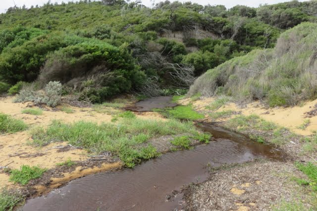
Fresh water was a potential problem for the entire trip and the advice had been to treat the second night’s camp at Tin Mine Cove as a dry camp; any potable water a bonus. We carried extra water for that camp, but it turned out that after Don filtered the local water, we had scored the bonus, even if there was a pronounced mineral taste to the water. Walk reports on the internet of trips early in 2020 gave mixed reports about the water supply at most campsites, but luckily we had no problems, apart from having to fight the undergrowth to get sufficiently upstream on Tin Mine Creek to reach the clearer faster-flowing water. Tin Mine Creek’s better water is not indicated by the coloured water lying limpidly across the beach, seeping into the sand and not quite reaching the water’s edge.
The campsites are small and there is a six-person per night limit. There are neither toilets nor the luxury of the piped water that constantly flows at the Sealers’, Waterloo or Refuge camps. Infuriatingly, toilet paper littered the outer perimeter of the camps; very disappointing. You would expect that the experienced walkers who venture into this wilderness area would be model citizens in the defecation department. Perhaps the boaties, who sometimes use the beachside camps, could be the culprits.
Tin Mine Creek
The weather, although mostly overcast, was kind to us.
From our vantage point at the Tin Mine Cove camp, in the afternoon and evening of day two, we could see rain showers heading across Corner Inlet from the southwest towards us. But for the most part, the rain moved around us, beyond our north-eastern side and we boiled our dinner water without resorting to parkas.
We were treated to overnight rain at the final camp at Five Mile Beach. Fortunately, we were able to dry our tents and pack up during a long break in the showers on the final morning. The weather on the westward walk across the Prom on the ‘management only’ Five Mile Track was showery for the most part. We three did not hesitate to bring out the pack covers, but there was no uniformity in the donning and removal of parkas as the intermittent showers of varying intensity, passed over us. Happily, the sun emerged for the last hour of that 18km crossing, so that we finished our journey warm and dry.
The author’s boots celebrated 11 years of existence and 125,000 kms of uncomplaining service with the sole separating from one boot and its companion trying to separate on the other boot. Fortunately, the toe end of the soles stayed put. Anthony did an excellent job of binding the sole at the instep with gaffer tape (without my having to remove the boot) and with the instep strap on my gaiters assisting, my boots made it to the end of the road.
We took four days, but effectively it was three days, and 60 kms. The Northern Circuit is a very hard walk.
It is immensely satisfying to complete a hard walk and see new country, particularly so, after you have recrossed the car park, deposited the pack and removed your boots from the weary feet at the bottom of your weary legs.
For beauty and coastal views, the North-Eastern corner of the Prom is the rather plain sibling of the overused Southern Section, but beauty is only skin deep. Don’t be discouraged, give some serious thought to this Cinderella and be pleasantly surprised.
The Corduroy between Chinamans Long Beach and Three Mile Beach
Walkers:
Don:
Leadership and Navigation
Anthony:
Morale and Botany
Paul:
Timekeeper – Rests and Lunchbreaks
Day 1 (afternoon):
Five Mile Track, Walking track to Lower Barry Creek Camp:
11 km
Day 2:
Chinamans Swamp, Chinamans Long Beach to Tin Mine Cove camp:
13 km
Day 3:
Cross the peninsula from Chinamans Long Beach to Three Mile Beach and Johnny Souey Cove and on to Five Mile Beach camp:
18 km
Day 4 (morning):
Five Mile Track to Car Park:
18 km
Notes
1. The Algona Guides ‘Map of Wilsons Promontory’ 1972 (price 20 cents) (see below) shows the track across the Prom between Chinamans Long Beach and Three Mile Beach as a vehicle track. This ‘cross Prom road is shown connecting to the rest of the world by a north/south road down the centre of the Singapore Peninsula, to the existing Five Mile Beach Road. The north/south road is now closed, even as a walking track.
2. A History of Wilsons Promontory National Park
Published electronically by the Victorian National Parks Association, May 2009

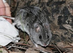 Citizen science plays a critical role in protecting threatened species, including through the Conservation Regulator’s
 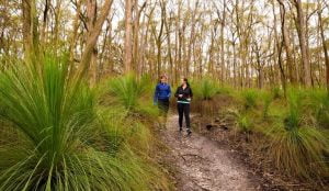 Parks Victoria is challenging walkers to explore 18 lesser-known parks with their ‘
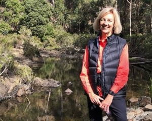 The Victorian Government has released a new feature on the Get Active Victoria website to assist Victorians to find places close to home where they can exercise –