Back in the day, a bushwalker’s emergency devices comprised a whistle, a box of matches and a mirror! Thankfully, things have moved on. When an emergency arises in the bush, contacting help can be stressful, but, by being prepared, you can be confident you will get help when required.
To ensure you’re adequately equipped, you’ll need to first consider the duration and location of your walk, mobile phone reception and whether it’s a solo or group walk. Here’s a short overview that explains how various devices work. The Bushwalking Manual contains a more detailed analysis.
Mobile phone
If you have mobile reception, dial 000 and ask for the Police
The Emergency Plus app lists a location in three ways: address, Latitude/Longitude and what3words. Emergency Plus is only an app, so it relies on the capabilities of the phone. When there is no phone reception, the app provides an error message when opened: hence it cannot replace a PLB or satellite communicator.
what3words is an app that provides position as a unique combination of three words. It’s not actually an emergency app, as it simply specifies location, but CANNOT connect you to emergency services. Interestingly, it still operates to some degree if your mobile has no reception, because the app downloads a considerable library of the 3-word positions, and it can match these to a position via the phone’s GPS, which is independent of phone coverage.
REMEMBER: No mobile reception = no connection to emergency services.
A variety of other devices are useful when there’s no mobile reception. A Personal Locator Beacon (PLB) is the simplest and most cost-effective, with a one-off purchase cost of approx. $320, free access to satellites and a battery life of 5-10 years. Other devices that access satellite networks also have an upfront cost, plus the ongoing cost of a subscription to a satellite network, which can easily overshadow the cost of the device.
Here’s a comparison of devices:
PLB
A PLB works completely differently to a phone. A modern PLB contains an accurate GPS: when activated, it transmits its position to a worldwide satellite distress network about once every five minutes. It will also transmit a rapid homing signal that can be picked up by air- and sea-craft. PLBs also contain a high-intensity strobe to attract search aircraft. No satellite subscription is required.
PLBs can be hired online, or from outdoor equipment suppliers.
Satellite Phone
This is the most expensive option – over $1000 for a handset before you sign up for a subscription. There are four networks for Australia, with Iridium (the most expensive) being the only really global network. An active satellite subscription is required. More information
Satellite phones can also be hired.
Other Satellite Communicators
Garmin devices with inReach technology: this includes the Mini Orange, Explorer+, GPSMAP 66i, Montana 700i and Montana 750i. inReach technology allows the user to SMS, send positions for tracking, get weather info and send an SOS message in an emergency. inReach uses the Iridium satellite network, which has the best coverage and largest number of satellites. An active satellite subscription is required; Garmin has a variety of packages. More information
SPOT devices, including SPOT GEN 3 & 4 and SPOT X 2-way. These devices send out a GPS location and message, which is relayed via satellites and read via the internet using email or text. The SPOT X can both send and receive texts and emails. These devices are particularly popular with solo walkers or searchers who have a base support team. SPOT uses the Globalstar satellite network (less satellites than Iridium) and an active subscription is required. There are a number of packages. More information
Zoleo Communicator: Zoleo links with a mobile phone app to provide satellite texting of GPS position and emergency contact via the Iridium satellite network. An active satellite subscription is required; Zoleo has various packages. More information
REMEMBER: A PLB or SOS button on a Satellite Communicator MUST ONLY be used in situations of grave and imminent danger, where you feel you are facing a life-threatening situation.
The difference between Mobile and Satellite Networks:
When in range of a phone tower, a mobile phone, being a communication system, is generally connected and instantly available; not so a satellite. Even using the Iridium network – which is primarily used for communication and has 66 satellites, each whizzing around the earth 14 times a day at an astonishing 27,000 kph – a satellite may not be ‘in view’ when your communication device is activated. Connection to the satellite network will also depend on terrain. One may need to wait quite a few minutes, or get to a better position, in order for the device to ‘see’ a satellite.
In comparison with other devices, a PLB uses six distinct satellite arrays, not one, and about 30 mission control centres. It usually takes only a few minutes for the registered next of kin to be notified if a PLB has been activated, and only a little longer to confirm the position and raise the alarm with the local search and rescue organisation. A PLB is designed for emergencies and uses a well-established emergency system. The other satellite communication devices have multiple functions, use only one satellite array and do not transmit the same emergency signals as a PLB.
So … if I were lying in the bush with no mobile reception and a broken leg, I’d have a PLB with me (as well as my ancient, trusty whistle!)
The Falls to Hotham Alpine Crossing (FHAC) is the third of Victoria’s Icon walks to be developed. The FHAC was first proposed around 2005 and became government policy in 2014. BWV’s main concerns with the development of the FHAC are outlined in submissions made to Parks Victoria in 2015 and 2017. These continue to be the BWV position and are available on the BWV website at https://bushwalkingvictoria.org.au/advocacy#
The project has very strong support from state and local governments, tourism bodies and local businesses. Funding of $15m for the project was included in the 2021/22 state budget.
BWV has two representatives on the Strategic Partnerships Committee (SPC) established by Parks Victoria to provide project management and consultation input to the project. Our representatives are Chris Towers, a former BWV president and board member, Eileen Clark from Border Bushwalking Club and BTAC Field Officer for the alpine area. Other members of the committee include a representative from the Victorian National Parks Association (VNPA), with the remainder being from government agencies such as Regional Development Victoria, and Falls Creek and Hotham resort management, Alpine Shire, and Tourism North East.
The three main aspects that concern BWV the most include:
Maintaining access to existing campsites,
Maintaining open access to the trail for independent walkers,
The siting and scale of huts, especially in the vicinity of High Knob.
Parks Victoria has already given commitments on the first two and plans for the accommodation are not yet detailed enough to enable an informed decision.
A comprehensive Environmental Values Assessment of the trail has recently been completed which entailed an on-ground assessment of the entire 57km route, including a 20m corridor on either side of the trail. This work gives an unprecedented insight into the flora and fauna that exist beside the existing trail and will inform further updates to the Master Plan. Typically Parks Victoria would release just a summary but have committed to publicly release the full report. This is expected in the next few weeks. One early decision resulting from this assessment is that the only new section of trail that had been contemplated, from Tawonga Huts to the saddle below Mt Jaimathong and on to pole 333, will now not proceed.
A Landscape Visual Impact Assessment will soon be undertaken by a separate consultancy that will look at minimising the visual impact of the trail and the planned accommodation. This assessment will be critical to informing the siting of the accommodation and will be closely scrutinised by BWV. Parks has recently stated that the trail will not be constructed as a ‘walkers highway’ with major work limited to protecting the environment from the impact of walkers e.g. track braiding on the Diamantina Spur.
BWV remains concerned about aspects of the project but is somewhat encouraged by recent decisions by Parks Victoria, and through its involvement on the SPC will continue to advocate strongly for the interests of as wide a range of bushwalkers as possible.
The preparation and experience of a new bushwalker
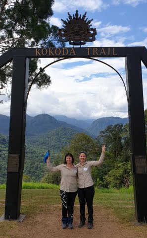
Liz Thompson, a member of the Melton Bushwalkers, walked the Kokoda Trek in July 2019. She shares her experience below.
My Kokoda experience started six months before I left. The ticket was booked by my sister who lives interstate and wanted to do the trek for her 50th birthday. I had six months to start training and I had no real bushwalking/hiking experience apart from a few weekend walks at the You Yangs. I had never really walked further than 5 km at a time. So the thought of 110 km in 9 days was a bit daunting but it motivated me to get cracking on the training. I had recently moved to Bacchus Marsh so I had the Lerderderg Forrest and Werribee Gorge at my doorstep. I looked up bushwalking groups on Facebook and that’s where came across the Melton Bushwalkers. I went on a few walks with them and met lots of wonderful people, I talked about my mission and a few members decided they would help me train in more challenging elevation outside of the regular group walks. So every Sunday, we went out for hours on end in the winter chill, climbing steep hills, getting a great workout all the while having great conversations.
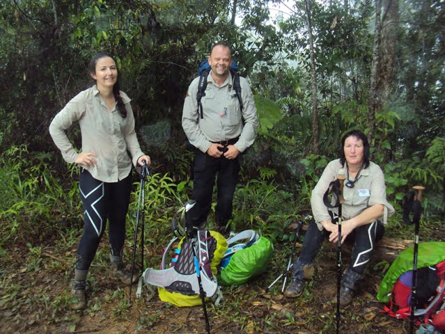
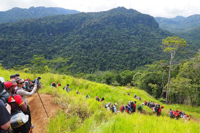
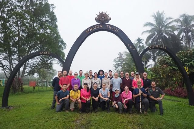
Fast forward 6 months later, I land in Papua New Guinea (PNG). It is hot and unbelievably humid for a Melbourne girl. The 25 walkers on our trek meet at the airport. Our trek leader, Major Scott Babington, herded us into an old bus headed for our accommodation before the trek starts the next morning. One thing to mention is the poverty that can be seen in Port Moresby. As soon as you leave the airport you can see the harsh conditions the locals live in. It was an eye-opening experience. Below is a short diary of each of the 9 days.
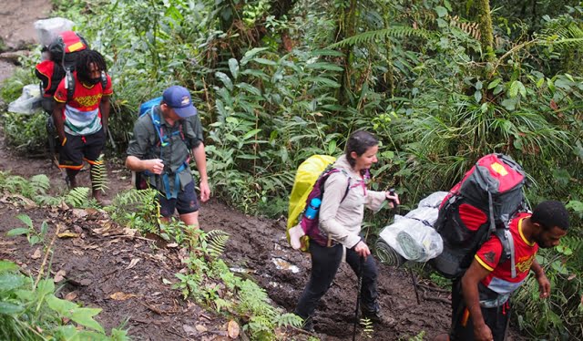
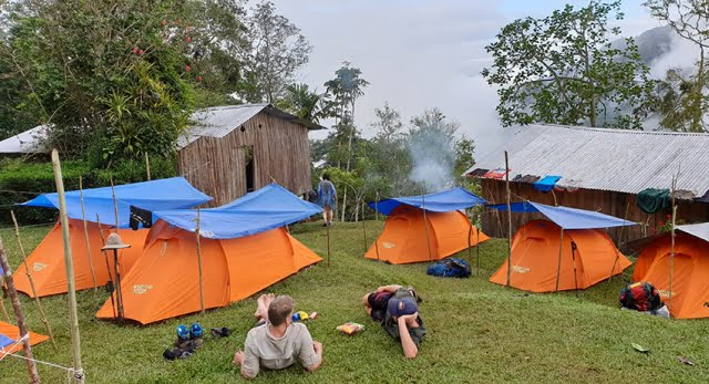
Day 1: We take the short 10 km drive to our starting point and meet our porters. These are men from the local villages who help carry some of our belongings. The weight is restricted to 12kgs, allowing for them to also carry their own stuff and not exceed the 18kgs limit imposed by our trekking company. Excitedly we all start the steep descent into the jungle. The temperature was around 28, it was humid but bearable. It was a short walk today, including a big river crossing then into camp and as soon as we arrived it started to rain. Everyone was in good spirits and happy to get to know each other. We get acquainted with our tents for the first time.
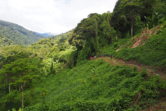
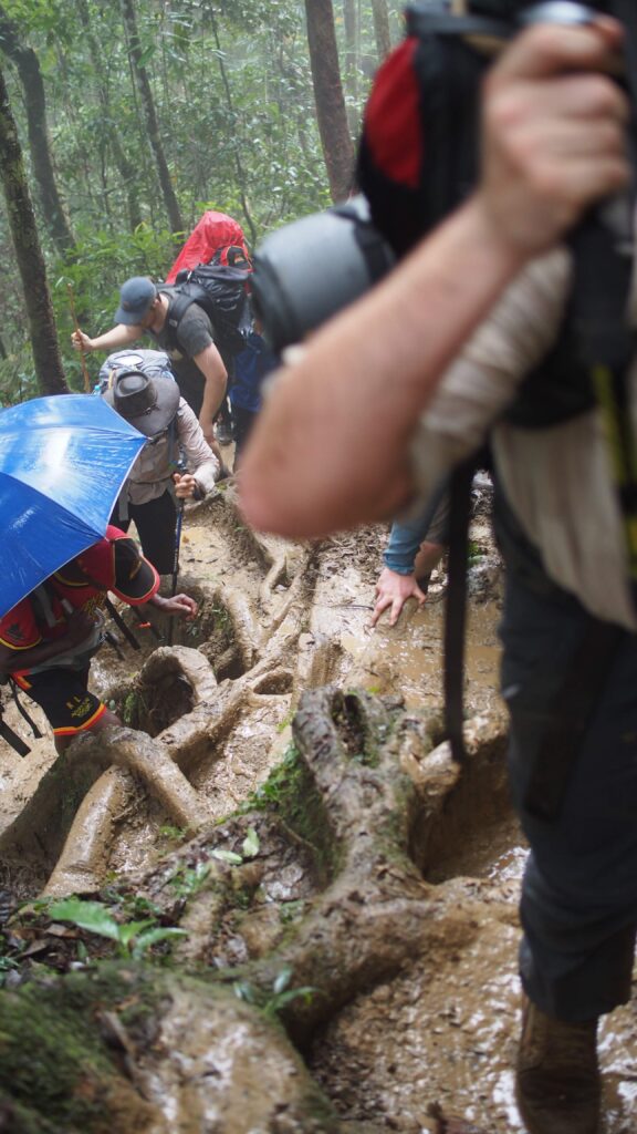
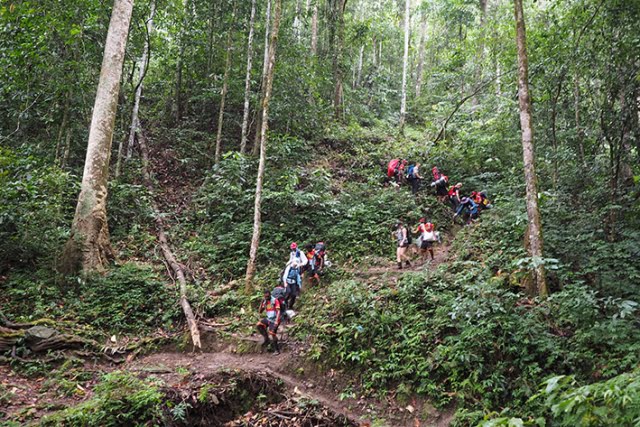
Day 2: The hills started. This is what I had been training for. The jungle was so beautiful, the twisted roots made natural staircases up the hills. The tree canopy kept the temperature down and whilst there was a little mud, it was OK. Even though the uphill was hard, sometimes the steep descents were more challenging. We reached camp after an 11-hour day, still high on the adrenaline of being here. Our fabulous trek leader gave in-depth talks at various stages on the history and significance of the areas we were walking on. That night, before dinner, however, I didn’t feel well. I was physically sick. I tried to eat something and then went to bed only to wake up and be sick again. Oh no….
Day 3: Described as one of the hardest days on the trek due to some of the sheer elevation of one mountain which was aptly named The Wall, I woke up, still unwell, dizzy, racing heart and nausea and wondering how exactly was I going to get through this. I missed breakfast and got straight into the 5.30 am start but 100 metres in I knew I was in trouble. While the other trekkers were ascending the first hill, I spoke to the trek leader and told him I was done. I felt so horrible, I couldn’t even fathom walking up a hill. Reluctantly he made the phone call for a medical evacuation. Turns out, at that time of the morning, no one answers their phone. I took an anti-nausea pill and after some tears, I actually felt a bit better and Scott said he would carry my backpack while I recovered, and reassess my condition up further … so I kept going. We reached the group that was waiting at the top of the first hill and three army reserve guys who were on our trek immediately stepped up and said they will take it in turns to help carry my backpack …. so I continued. I made it up “The Wall” and “Wall 2.0” and all the way to the next camp 12 hours later. It poured rain all day, everyone was wet through, muddy and exhausted. It was one of the hardest days in my life and a day I will always remember. Not because of the bad, because of the way everyone in the group helped me out, kept my morale up and got me through.
Day 4: Feeling slightly better, I had assistance with my bag again today. Another gruelling climb and hard day but getting it done. One of the highlights of the Kokoda trail is going through the villages on the way. The kids all come out and wave and smile and say hello. At some villages, they sell treats like cans of soft drink, small packets of Twistee’s and local fruit like bananas, pawpaw or coconuts. It rained on and off all day but we had bouts of the sun to dry us off.
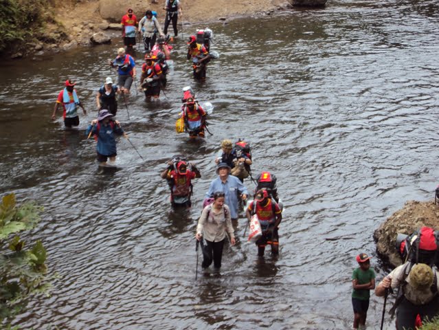
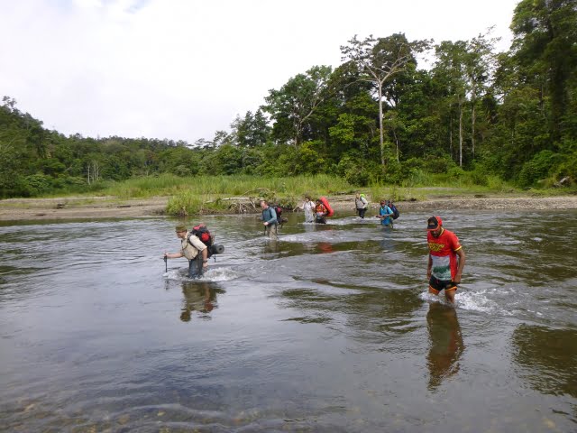
Day 5: There are many places of interest along the trail but some that have more significance than others. Today was a highlight as we made it to Brigade Hill, an impressive mountain ridge that is roughly halfway through the trek. The spot saw a great battle in September 1942 as the Australians tried to hold the advancing Japanese. We had a short ceremony here and paid respect to the soldiers who lost their lives on this battleground. Another thing that became a staple on the trek were river crossings – sometimes we had a fallen tree to cross on, and some we had to walk through waist-deep.
Day 6 – 7: By now everyone has settled into a routine. It was hard at first trying to pack up your gear every morning in a tent but by day 6 I have finally worked out some tricks. One interesting thing, you rarely see any animals in the jungle. You might be lucky to see the odd bird and a few mozzies but I was surprised that there were no animals around. There is also very little colour, just the brown ground and green trees. There were a few fungi around but not many flowers. Occasionally the trail would lead to an open space on the side of a mountain but for the most part, we are in under the canopy of the trees. When there was a view, sometimes you couldn’t see it because of the cloud cover.
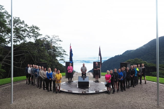
Day 8 – By far my favourite day as we had an amazing dawn service at the Isurava Memorial. A beautiful memorial, literally in the middle of the jungle. I later discovered the memorial materials were brought in by helicopter. Four huge granite stones, each inscribed with a single word – Courage, Endurance, Mateship, Sacrifice. The significance of getting here and hearing the letters written by soldiers and poems after we had walked in their footsteps was amazing. We understood what those 4 inscribed words really meant as we were nearly at the end of our journey. From here we started a descent into Kokoda for our final night.
Day 9 – It was a different atmosphere waking up today. We were no longer in the jungle and we had a short walk to the airfield. On the way, we were treated to a baked breakfast and cultural show before heading to the airfield. The airport consisted of a concrete slab with a tin roof and a lady with a clipboard who weighed our bags and us and wrote it all down in her book. After less than an hour’s flight in a small plane, we were back in Port Moresby. On the way back to the lodge we visited the Bomana cemetery where over 4500 Australians lie buried. It is hard to look at all the headstones, mainly young and ill-prepared boys 18 to 20 years old. It was a very emotional experience having walked through the jungle, and to know what they had to endure and the conditions that they would have had no time to prepare for.
Upon reflection of my time at Kokoda, it’s hard to put into words the profound effect that experience has on you. It’s not just a journey you take for a physical challenge even though it is physically very challenging. It was also a very mentally challenging experience of having to push through when you think you can’t walk up to another hill, and the emotional journey, the empathy you have for those soldiers who did the same trek but in much worse and harsher conditions. It certainly piqued my interest in finding out more about Australia’s role in WW2. The amazing people you meet and bond with over a very unique experience I would highly recommend.
All weather Notepads are great for taking notes and writing down magic moments whilst on a walk.
Long folding spoon that is long enough to scrape the bottom of deep rehydrated dinner bags and easy to store together with her favourite freeze-dried meals.
A rugged, waterproof smartphone case and portable charger.
Enjoy finding that something special for your mum!
Having discovered the benefits of exercising outdoors during the Covid Lockdowns, many of us are keen to keep the momentum going. We have come to realise just how important outdoor physical activity is to our health and well-being.
If you would like to venture further afield to exercise in natural surroundings; to use walking tracks that will lead through our wonderful native forests, to visit a waterfall or a mountain creek hidden away from the roads, or off the beaten track, a lookout over a valley of tree ferns; – you should try bushwalking.
A bushwalk can be a short non-taxing way to exercise or an all-day strenuous workout, or anywhere in between, the choice is yours. If you want to go on your first bushwalk or start bushwalking regularly, a great way to start is to walk as with a bushwalking club. Clubs’ programs cater for all levels of fitness. They provide walks in a variety of locations, with differing time commitments, distances and degrees of difficulty. Clubs have experienced walk leaders among their members who do the planning and preparation, and know their walks.
Most Bushwalking Clubs welcome new bushwalkers, so please do not hesitate to contact one or more clubs that interest you to find out about how to join them as a guest on a walk or become a member. Most clubs affiliated with Bushwalking Victoria have their program of upcoming walks online. Have a look at the club programs from the list below. For a full list of clubs and their contact details, click here.
Members of the Bayside Bushwalking Club took a walk on the wild side in March 2020, exploring the north-east corner of the Prom. Written by Paul Redmond.
The official ‘Park Notes’ for the Northern Section of Wilsons Promontory are quite discouraging. Walks’ Reports posted on the internet are not all that encouraging either.
This unlikely wilderness sits over there, across the flat country, to the east of the bitumen road to Tidal River. It beckons and tries to tempt the bushwalker with an inaudible siren call, “Turn your car into Five Mile Road and abandon that walk planned to commence at Telegraph Saddle”. We barely notice the grey/blue hills to the east. Your itinerant bushwalker remains aloof and never visits this mysterious north-east corner of the Prom.
Now, at long last, I have seen it first-hand and it is good.
The Northern Circuit is certainly not for the faint-hearted nor the unfit nor the unprepared. It is a hard walk done in long daily stages due to the distance between the relatively few campsites and the condition of the tracks. These remote camps are limited to six persons per night. There are limited assured water supplies and no Plan B optional routes. You are unlikely to meet anyone on the 60 km circuit. Some go clockwise others prefer the reverse. We went clockwise.
The majority of the circuit’s component tracks are overgrown and consequently hard to follow. You are pushing through dense scrub varying from knee-high to two metres and higher. There are numerous blind culs-de-sac caused by so many having gone astray at the same point, typically following a wombats’ runway, deviating around the prickles of Hakea or the points of a Xanthorrhoea or by just missing an unexpected right-angle turn. The tracks have more meanders than the Brisbane River. We lost the track quite often, but could quickly realise our error and recover, thanks mainly to the leader’s GPS or less technically, three pairs of eyes searching high and low for the elusive pink tapes that mark the true path of righteousness. These tapes vary from bright pink that contrasts clearly with the background, through to faded pale remnants that are hard to spot. New or old, they may be wrapped around a branch, high or low; flapping in the wind from a mere slip of a branch or tied to a juvenile trunk top that can barely support its own weight in the wind. You are never sure where to look.
The foot track, a narrow shallow groove in the ground, can be followed with care, but one cannot spend a whole trip staring at the ground. The scrub’s branches have grown over the track and they close ranks immediately behind the walker you are following, barely three metres in front. You can see where they are, but not how they got there. It was hard and tiring, constantly pushing through the scrub. Fortunately, most of the scrub we encountered had quite soft and flexible juvenile growth.
There is, however, plenty of resistant mature growth and hard deadwood with sharp broken ends to scratch an uncovered arm and sometimes draw blood on a covered arm with no damage to the protective sleeve. Compensating areas where the scrub is knee-high and not such hard work do exist, but even there the track can still be hard to follow.
Track Marker – But Where is the Track?
Being a wilderness area the signage is sparse; often old and faded.
Chinamans Long Beach
Five Mile Road is a closed Management Road that crosses the Prom running almost due east from near the southern reach of Corner Inlet. It is a tacit dividing line between the north and south sections of the Park. It is the way into and the way out of this wilderness.
We departed the car park on Five Mile Road at 1:30. The undulating gravel surface of the road eased us into the start of this expedition. The expansive views of Corner Inlet to our north-west (left) were revealed afresh at the top of each rise. Always in view is the scrubby flat country to the north-east which contains Chinamans Swamp and its marshy environs.
The undulation of the scrublands is relieved by many clumps of trees and small rises and typical Prom rocky outcrops. Mount Vereker (638m) and Five Mile Peak (475m) stay in view at the southern edge of the wilderness. Roundback Hill (314m), Mount Margaret (219) and Mount Hunter (348m) run to the north-east in a distant line. Mount Singapore (145m) is just visible at the northern tip of what J. Ros Garnet refers to as the Singapore Peninsula in his ‘History of Wilsons Promontory’.
Descending a small rise, we see a green Parks’ sign planted in the sandy runoff beside the road, standing authoritatively in front of the dense scrub. It proclaims “Lower Barry Creek 4.3km” and “Tin Mine Cove 18.9km” with each notation accompanied by a broad arrow pointing to the sky. Good so far; but where is this sign-posted track. There is not even the slightest gap in that wall of scrub to indicate the track into the wilderness. After much examination of the area, eagle eyes recognised a change in the patterns in the sand revealing where to part the scrub and step through the curtain onto the track. Talk about “What’s behind the Green Door?”
And so we were into it. Not quite the great unknown, but if the entrance is a guide, who knows what this afternoon may bring.
The Track Is Through There, …Somewhere
Two hours and twenty minutes (and 4.3 kms.) later, the party emerged from the scrub where the track crosses Barry Creek. A long stride across the leisurely flowing black tea coloured water, up the steep sandy bank and we were standing in the camp. When written down, the afternoon’s distance does not seem that much, but your author, for one, was very glad to reach the mysterious Lower Barry Creek Camp. I anticipated that this camp would be quite unlike the more familiar southern section camps that sprawl among the tea trees behind a beach. And it is; a small clearing hiding in the forest with just enough space to accommodate the regulation maximum of six walkers; in fewer tents.
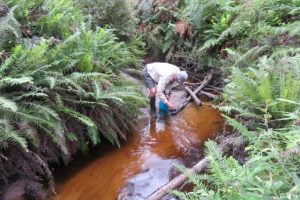
Don collecting some ‘black tea’
Mid-morning on day two saw us crossing the infamous Chinamans Swamp. We were lucky. Most of the swamp that we transited was just damp, squashy or even dry. The three recognisable water courses that crossed our appointed way were knee-deep in opaque muddy water that just hovered over an unseen, very soft and uneven bottom. It seemed as if we were walking along the creeks, not crossing them. No luxury of boardwalks in the wilderness.
It could have been worse. Horror stories of seemingly endless waist-deep swampy sections, are told by the intrepid who have passed through in wetter seasons. I was elated when I realised that we had just stepped up from our last quagmire. I exaggerate. It was more muddy water than watery mud, with green ribbon-like weed growing in the water and floating languidly on the surface.
Having passed through the swamp, there was about one and a half hours through the difficult scrub to the southern end of Chinamans Long Beach. From the rises on the track we were treated to expansive views of the huge saucer which is drained by Chinamans Creek and Barry Creek into Corner Inlet. Track conditions gradually improved as we approached the beach, as scrub gave way to tea tree and the track surface gradually became sandy, indicating that the beach (and lunch) was not far ahead.
A gusty wind on the beach sent us back into the shelter of the foreshore tea tree for lunch. Anthony discovered Warragul Greens growing at our picnic spot, but no one moved to supplement their rations. A four kilometre walk on the wave compacted sand to the northern end of Chinamans Long Beach brought us to a track to take us above the rocks and the headland and around Tin Mine Hill to the Tin Mine Cove camp. We arrived at the respectable hour of three o’clock or thereabouts; this seemed to satisfy our leader’s desire for punctuality.
We braved the cold sea for a brief swim at the Tin Mine Cove beach. We could have used a swim yesterday afternoon at Lower Barry Creek Camp after the warm first afternoon.
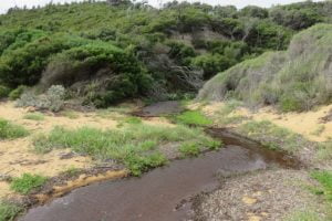
Chinamans Swamp
The tracks pass through many sylvan patches of Banksia forest. A pleasure to pass through, to admire the gnarled old trees with bark-like hard old blue-grey leather, all splits and knobs They are such a contrast to the adjacent younger slimmer saplings, branching out abundantly with new growth displaying fresh green leaves. It is not all doom and gloom. There are sections of track that are easy to follow with no thorny flora, passively waiting to attack the labouring bushwalker.
Fortunately, the hills are gentle. The track, for all its shortcomings, has no replications of the long climb up to Telegraph Saddle or the knee destroying climb up to the Lighthouse precinct past the concrete helipad.
There were two precipitous descents on to beaches. If you had chosen the counter clockwise circuit, they would be very hard going as your feet slipped and sank into the loose sandy soil; handholds proving to be unattached to the soil, despite the appearance of security.
The scrub bashing was offset by two long beach walks – Chinamans Long Beach on the western side and Three Mile Beach on the eastern side. Beach walking is seen by some as boring, but there is pleasure in walking on a gently undulating beach, more or less in a straight line, except when searching for harder sand. I concede that a beach that slopes steeply from foreshore to waters’ edge is a pain in the downhill knee. If you are ambushed by a silent rogue wave as you walk the hard sand near the water’s edge, lost in a beachcombing reverie, it is a serious pain in the bottom. The beach sections were such a pleasant relief to the hard work pushing through the inland scrub with eyes constantly on the lookout for the next pink track marker and wary for reptiles basking on open sunny sections of track.
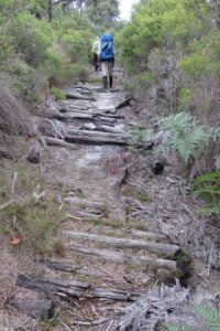
The track eastwards across the Prom, on day three, from Chinamans Long Beach to the lattice navigation light tower above Three Mile Beach was easy to follow for the most part. It had been cleared by Bushwalking Victoria volunteers about five years ago, but nature does not sit idle, another two to three years will see sections of the track all but disappear under the vigorous regrowth. Towards the middle of the crossing, a short length of the track is formed by an ancient corduroy surface. The logs forming the path are held in place by rusted steel cables secured to the logs by thin dog spikes. The substantial thick cables have deteriorated and parted from the logs whose charred ends showed that they had been burnt in a bushfire in years past. It is a relic of the bygone days when the track was formed for vehicles. Only a truck could have carried those cables to the site. Presumably, they were scavenged from the abandoned tin mine near Chinamans Beach (the short one north of Tin Mine Cove).
Day three included a brisk march along Three Mile Beach. Here, with their feet and trunks buried in the creamy coloured sand, the grey skeletons of large trees stand tall with an eerie starkness, against the green backdrop of the hills at the end of the beach. There are many reclining tree trunks lazing about, but they lack the gaunt starkness of the upright ghosts.
We lunched at the southern end of Three Mile Beach.
Three Mile Beach
Between Three Mile Beach and Johnny Souey Cove the track skirts around Three Mile Point which rises above the waves crashing in from the Southern Ocean onto the granite boulders with their coating of the endemic orange lichen. We discovered the hard way that there is more than one track around or indeed, over Three Mile Point. The main track which is clear and well defined eluded us as we fell to the temptation, after lunch, to take the first indication of a track. We followed some intermittent and elusive fading pink tags, heading uphill on an abandoned track which deteriorated to “route only”, a term I first saw on Duncan Brookes’ VMTC maps of walking areas in the High Country.
What remained of the track eventually disappeared from under our feet, leaving us pointed uphill and nowhere to go. The GPS would have told us, had it come equipped with a voice, that we should have walked a few metres further around the beach after lunch to where we would have easily picked up the cleared track – the track that did not climb high over the hill, but followed the contour around just above of the rocks and the waves.
To recover our position without retracing our steps, we compromised between blindly progressing over the hill towards Johnny Souey Cove and dropping directly towards the crashing waves. We did this by taking an oblique route down through the scrub towards our destination. This action slowly progressed our journey and brought us to the elusive well defined cleared track and the resultant increase in pace.
We ‘passed’ on an inspection of the Johnny Souey Cove campsite and pressed on in the luxury of a good cleared track over the divide separating the two bays. From our vantage point, we could see several runabout boats in the lee of Rabbit Island as well as between Monkey Point and Rabbit Rock.
As Anthony remarked, “No doubt those fishermen are looking up at us and wondering why people would choose to walk those hills with a load on their backs”. “They could be sitting down like us with some luxuries and no effort involved when you wish to relocate to another place where the fish could be biting”.
The day finished with a precipitous drop into Five Mile Beach. Low tide meant we could rock hop across Miranda Creek with dry boots. Camp was just off the beach.
A spring emptying into Miranda Creek delivered the best water of the trip; very weak black tea. The flow at the spring was quite strong, but most of it was inaccessible under rocks. The small flow that was available to the thirsty bushwalker was efficiently directed into water bottles by means of a short flexible plastic tube carried by one of our number for such a purpose.
Another swim – very cold; very brief.
Fresh water was a potential problem for the entire trip and the advice had been to treat the second night’s camp at Tin Mine Cove as a dry camp; any potable water a bonus. We carried extra water for that camp, but it turned out that after Don filtered the local water, we had scored the bonus, even if there was a pronounced mineral taste to the water. Walk reports on the internet of trips early in 2020 gave mixed reports about the water supply at most campsites, but luckily we had no problems, apart from having to fight the undergrowth to get sufficiently upstream on Tin Mine Creek to reach the clearer faster-flowing water. Tin Mine Creek’s better water is not indicated by the coloured water lying limpidly across the beach, seeping into the sand and not quite reaching the water’s edge.
The campsites are small and there is a six-person per night limit. There are neither toilets nor the luxury of the piped water that constantly flows at the Sealers’, Waterloo or Refuge camps. Infuriatingly, toilet paper littered the outer perimeter of the camps; very disappointing. You would expect that the experienced walkers who venture into this wilderness area would be model citizens in the defecation department. Perhaps the boaties, who sometimes use the beachside camps, could be the culprits.
Tin Mine Creek
The weather, although mostly overcast, was kind to us.
From our vantage point at the Tin Mine Cove camp, in the afternoon and evening of day two, we could see rain showers heading across Corner Inlet from the southwest towards us. But for the most part, the rain moved around us, beyond our north-eastern side and we boiled our dinner water without resorting to parkas.
We were treated to overnight rain at the final camp at Five Mile Beach. Fortunately, we were able to dry our tents and pack up during a long break in the showers on the final morning. The weather on the westward walk across the Prom on the ‘management only’ Five Mile Track was showery for the most part. We three did not hesitate to bring out the pack covers, but there was no uniformity in the donning and removal of parkas as the intermittent showers of varying intensity, passed over us. Happily, the sun emerged for the last hour of that 18km crossing, so that we finished our journey warm and dry.
The author’s boots celebrated 11 years of existence and 125,000 kms of uncomplaining service with the sole separating from one boot and its companion trying to separate on the other boot. Fortunately, the toe end of the soles stayed put. Anthony did an excellent job of binding the sole at the instep with gaffer tape (without my having to remove the boot) and with the instep strap on my gaiters assisting, my boots made it to the end of the road.
We took four days, but effectively it was three days, and 60 kms. The Northern Circuit is a very hard walk.
It is immensely satisfying to complete a hard walk and see new country, particularly so, after you have recrossed the car park, deposited the pack and removed your boots from the weary feet at the bottom of your weary legs.
For beauty and coastal views, the North-Eastern corner of the Prom is the rather plain sibling of the overused Southern Section, but beauty is only skin deep. Don’t be discouraged, give some serious thought to this Cinderella and be pleasantly surprised.
The Corduroy between Chinamans Long Beach and Three Mile Beach
Walkers:
Don:
Leadership and Navigation
Anthony:
Morale and Botany
Paul:
Timekeeper – Rests and Lunchbreaks
Day 1 (afternoon):
Five Mile Track, Walking track to Lower Barry Creek Camp:
11 km
Day 2:
Chinamans Swamp, Chinamans Long Beach to Tin Mine Cove camp:
13 km
Day 3:
Cross the peninsula from Chinamans Long Beach to Three Mile Beach and
Johnny Souey Cove and on to Five Mile Beach camp:
18 km
Day 4 (morning):
Five Mile Track to Car Park:
18 km
Notes
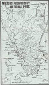
1. The Algona Guides ‘Map of Wilsons Promontory’ 1972 (price 20 cents) (see below) shows the track across the Prom between Chinamans Long Beach and Three Mile Beach as a vehicle track. This ‘cross Prom road is shown connecting to the rest of the world by a north/south road down the centre of the Singapore Peninsula, to the existing Five Mile Beach Road. The north/south road is now closed, even as a walking track.
2. A History of Wilsons Promontory National Park
Published electronically by the Victorian National Parks Association, May 2009
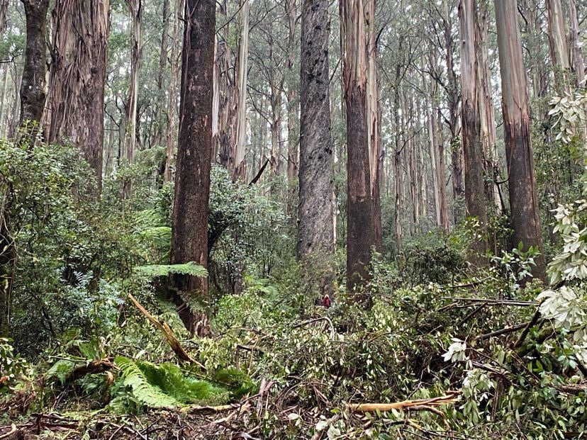
Bushwalking Victoria calls for logging to be suspended in all native forests until a full and proper assessment of the impact of the bushfires is completed, including loss of habitat and impact on biodiversity of flora and fauna.
Very large areas of forests have been burnt and large number of native animals killed. This has had major impacts on native plants and animals, including threatened species and their habitat.
Logging of significant old growth native forest is proceeding in the Kalatha Valley and elsewhere near Toolangi and Warburton in the Central Highlands close to Melbourne. These remaining forests are popular with bushwalkers, locals and tourists and they provide habitat vital for several threatened species including Leadbeaters possum, the Spot-tailed quoll and the Powerful owl.
Scientists including Professor David Lindenmayer and Dr Chris Taylor have also advised their research demonstrates that logging makes native forests more prone to fire. The safety of local communities and bushwalkers visiting forests must take precedence over commercial logging.
The salvage logging that is proceeding in some fire-affected forests in Gippsland will compromise the recovery of these forests and is destroying the remaining habitat of native animals that survived the bushfires. This must also be halted.
All logging in native forests should be suspended until rigorous and thorough scientific studies assessing the impact of the catastrophic 2019-20 bushfires in Victoria are completed.
Peter Campbell, Environment Spokesperson, Bushwalking Victoria
Bushwalking Victoria has published an updated Bushwalking Manual that provides guidelines and information for safe, enjoyable community-based volunteer bushwalking in Australia. The manual includes contributions from other state and territory peak bushwalking organisations.
Feedback and suggestions are welcome and can be provided using links on the feedback page.