Distance: 19 Km | Duration: 5 Hrs | Grade: Grade 3 | Rating: | Style: One Way | Map
About the Walk
Overview
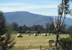
The Warburton railway line was opened in 1901 to ferry farm produce from the Yarra Valley to Melbourne and closed in 1965. The Rail Trail follows the historical railway line through the Yarra Valley with its mountain scenery, bushland, open river flats, farmlands and forests. The trail crosses restored bridges and passes remnants of the former station platforms. The walk ends at the original 1882 railway station which houses the Upper Yarra Museum.
The Walk in Detail
Commencing at the Wandin Station the walk follows these well signposted stages: Wandin – Seville 4.1km; Seville – Killara 3.6 km (bushland down onto open pastures to Killara Station); Killara – Woori Yallock 4.4km (descends into the Yarra River flood plains with views of the Central Highlands to the northeast, as you pass through grazing land and across the 175m Woori Yallock Creek bridge); Woori Yallock – Launching Place 6.8km (pass timbered grazing land on the banks of the Yarra River before crossing the highway to enter Launching Place); Launching Place – Yarra Junction 2.4km. (follow the Warburton Highway up into Yarra Junction to the finish at the original 1882 railway station).

