Distance: 15.5 Km | Duration: 6 Hrs | Grade: TBA | Rating: | Style: Circuit | Map
Best Season: Autumn, Spring
About the Walk
Overview
A classic, challenging and scenic walk in the southern part of the Lerderderg Gorge. The walk takes in the Lerderderg River and steep spur tracks with spectacular views of the river and the gorge.
The Walk in Detail
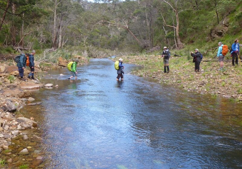
Some forest road walking. Two steep climbs and descents, 400m change in elevation. Two river crossings; wet feet likely.
Start: Mackenzies Flat picnic area (LER200).
- Walk north-west beside Lerderderg River, crossing the river twice, towards Grahams Dam. Distance 2km.
- Near Grahams Dam (LER500), cross the river twice and climb Spur Tk, a steep narrow footpad, initially north-west and then north to the junction with Lerderderg Tunnel Access Tk. Veer left into Lerderderg Tunnel Access Tk (LER507) and continue north to next junction. Veer left, pass through a gate, and continue north to Lerderderg Weir (LER508). Distance 4km.
- Cross the Lerderderg River (LER509) and climb west on Long Point Tk to the junction with Blackwood Ranges Tk. Distance1.8km.
- Turn left onto Blackwood Ranges Tk (LER510) and walk south. Pass Link Tk No 2 (LER505). At LER506 turn left and walk east to junction with Link Tk No 1. Keep left on Link Tk No 1 and descend steeply to the river crossing near Grahams Dam. Cross the Lerderderg River. Continue south-west beside the river, crossing the river twice, to the end point of the walk. Distance 6.7km.
End: Mackenzies Flat picnic area (LER200).
Disclaimer: All reasonable effort has been made to ensure that the route description was as accurate as possible at the time of publication.
The accompanying map is general in nature and should not be relied on for navigation purposes.
This park is infected with Cinnamon Fungus. Please observe the following control measures:
- Be clean on entry and exit. Vehicles, tyres, machinery, footwear and camping gear should be free of soil, gravel and mud prior to entering or leaving any park, reserve or campsite (particularly in high risk areas). Don't bring soil or gravel in – and don't take any home!
- Where available, use boot cleaning stations and vehicle wash down bays – they are there for a reason.
- Remain on formed roads, tracks and pathways at all times. Moving from infected to uninfected areas can spread the pathogen - particularly during wet weather when soils are wet and sticky.
- Obey all track and road closure signs. Do not enter areas of vegetation that have been quarantined.
For full details on the fungus and required control measures please follow link provided in Further Information below.
Getting There
Drive on the Western Highway via Melton and Bacchus Marsh, taking the Bacchus Marsh exit from the highway. Follow C704 towards Gisborne for 1.8km and turn left along the Lerderderg Gorge Road. Drive for 5.4 km until reach Mackenzies Flat picnic area.
Walk Precautions
High water levels may make river crossing difficult. Cinnamon fungus area.
Additional Information
Mackenzies Flat picnic area: 


