Distance: 12 Km | Duration: 7 Hrs | Grade: Grade 4 | Rating: | Style: Return | Map
Best Season: Summer, Autumn, Spring
About the Walk
Overview
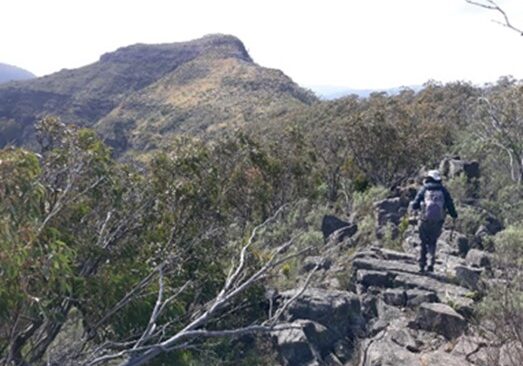
A steep climb up the spur to the ridge-line, then north along the ridge to the final climb over the rocky terraces and a heart stopping ridge to the summit of The Crinoline (Mt Ligar) with fabulous 360 degree views. Lunch at the top and then an equally steep descent!
The Walk in Detail
This is the Federation Walks Weekend signature walk. Start walking north from Breakfast Creek climbing a steep spur on the McMillan Walking Track. This part of the track is in excellent condition. The climb is made a little easier by the 30 zig-zags (to Smith Street). The track veers north west on a knoll at 748m. Keep following up the spur to the Sugarloaf-Crinoline ridge, then turn north along the ridge to the Crinoline (Mt Ligar). More climbing with less distinct zig-zags and then a scramble across rocky terraces and through some scrub to the summit. The summit offers 360 degree views. Test your knowledge on the many summits and ridge lines that are visible. Descend off The Crinoline back to a ridge then south along the rocky ridge to pick up McMillans Walking Track and descend back to Breakfast Creek and cars. There are no toilets. Carry sufficient water, lunch, sturdy footwear. Carry suitable alpine weather clothing for this walk. Conversely it can be extremely hot. Gaiters and walking poles are recommended.
Getting There
From Licola Village, head north following the Wellington River on the Tamboritha Rd to Breakfast Creek, parking on the left at the Breakfast Creek bridge or the Melbourne Grammar camp on your left, 200m before second crossing of the Wellington River. Distance from the Licola Wilderness Village to the start of the walk is 19 km.

