Distance: 8 Km | Duration: 3 Hrs | Grade: TBA | Rating: | Style: TBA | Map
About the Walk
Overview
The walk mainly follows the old Moe-Walhalla rail line and includes a side walk to Horseshoe Bend tunnel.
The Walk in Detail
The walk mainly follows the old Moe-Walhalla rail line and includes a side walk to Horseshoe Bend tunnel. It passes through heavily forested terrain and is rich in wildflowers over spring. The area was largely denuded for timber for gold mining at the end of the 19th and beginning of the 20th centuries.
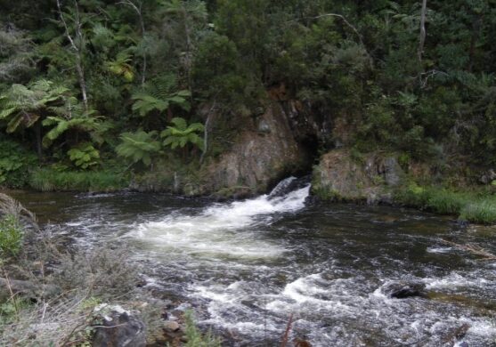
Gippsland Water Dragons can occasionally be seen basking on rocks in the river bed. Horseshoe Bend Tunnel was constructed in 1911 to divert water to enable gold mining from the dry river bed. The tunnel exit is quite spectacular as the full force of the Thomson River comes rushing out of the sheer mountain side.
The walk ends at Thomson Station.
This is a one-way walk, so a short car shuffle is required from Knotts Siding to the conclusion of the walk at Thomson Station.
Getting There
From Moe, 130 km East of Melbourne on the Princes Highway, take the Moe-Walhalla Road C466 through Erica, then turn right onto the onto Knotts Siding Road C481. Continue through Rawson to the start of the walk at the junction of the Knotts Siding Road/Walhalla/Tyers Road. The walk starts at Knott's Siding, approximately 2 km south of Rawson on the Tyers-Walhalla Road at the junction of the turnoff to Walhalla.Walk Precautions
Additional Information
There is a general store, bakery, cafe, hotel and toilets at both Erica and Rawson. There is some interpretive signage on the rail trail.

