Distance: 3.8 Km | Duration: Hrs | Grade: TBA | Rating: | Style: Circuit | Map
Best Season: Autumn, Spring
About the Walk
Overview
An easy walk that explores an unusual rock formation made famous by the film 'Picnic at Hanging Rock'. Although this walk is short it is rated medium because of an uphill walk to the top of the rocks which, has some quite steep sections and requires walking over rocks at the top.
The Walk in Detail
There is an excellent brochure available at Hanging Rock Reserve at information boards and the Hanging Rock Discovery Centre (but not online). It includes a map of the walking track and you should pick up a copy prior to commencing the walk.
Hanging Rock is a rare example of a volcanic feature known as a mamelon and was formed six million years ago when a particularly stiff type of lava formed a rounded pile of layers on the surface as it was squeezed through a narrow vent in the earth. It is also the location in the film 'Picnic at Hanging Rock' where several school girls disappeared.
This walk starts at the walking track located behind the building complex housing the cafe and Discovery Centre. There is a circuit walk around the base of the rocks and another track that takes you to the top of the formations.
The Base Walking Track goes in a clockwise direction (go left) doing a complete circuit of the formation. It is a wide, easy path, with some undulations, that allows you to see the rock formations and vegetation on the lower slopes. It is clearly signposted with arrows. Estimated distance is 2km.
As you return to the starting point, take the signposted bitumised track on your right that heads uphill. There are 20 places of interest marked on the map of the Rock that is provided in the information brochure.
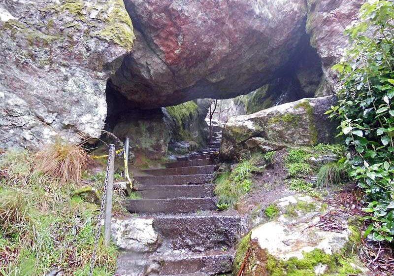
Initially the gradient is steady but this does become quite steep for a short section towards the top. The sign advises you to allow 50 mins for the 1.8km (return) trip. After a short distance the track offers a choice of a slightly more gradual climb along the track (by veering left) or the steeper route that includes stairs (go right). You may wish to go up one way and back the other way. You will find the hanging rock which gives the Reserve its name on the route with the steps. The two tracks rejoin further up amongst the rocks. Past this junction the track then curves around to the right before dividing in two. The right hand track takes you exploring through the rocks and you need to return along the same route. The left had track weaves around various rock formations and takes you higher. There are good views of the surrounding countryside from a number of points at the top. The final section of the track involves walking over and around rocks which can be very slippery when wet. Once you have finished exploring retrace your route back to the bottom.
For good views of the Rock from a distance walk across to the racetrack. A mob of kangaroos can often be found here.
Getting There
Take CityLink (will need to pay the tolls) and then the Calder Freeway north towards Kyneton. Take the Woodend-Wallan/C324 exit. In 400m turn right into Woodend-Lancefield Rd. After a further 3.5 km turn left into Coach Rd/C324 and almost immediately right into South Rock Road. Follow this road for approx 1.5km to Hanging Rock Reserve.
Walk Precautions
Shoes with good traction recommended as the track and rocks can be slippery in wet weather. Snakes may be active in warm weather.
Additional Information
Start of walk: 


