Distance: 19 Km | Duration: 5.5 Hrs | Grade: Grade 3 | Rating: | Style: Circuit | Map
About the Walk
Overview
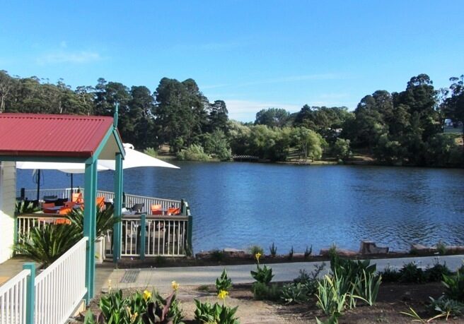
This walk begins at Lake Daylesford, an artificial lake crated in 1930 at the site of the Wombat Flat Diggings where gold was mined heavily in the 1850s. The walk follows the Lerderderg Track and affords an extended view of Daylesford from Cornish Hill. The track passes mullock heaps from disused mine shafts as it follows the route of the old Daylesford-Ballarat railway line to Jubilee Lake. The walk continues through the Wombat Forest and farmland jto Sailors Falls which offers mineral springs and a cool lunch shelter. The return journey through the Hepburn Regional Park on the Goldfields Track gives much evidence of the gold rush era.
The Walk in Detail
Start the walk at Lake Daylesford (Grid Reference (GR) 465627) and follow the trail on the south-western side of the lake and walk along the dam wall turning north onto the Peace Mile track. Continue around the Lake for 1km left up the steep footpath track to join the Ballan-Daylesford Road. Turn left, cross the main road and walk to the Cornish Hill Lookout (GR 472627) via Stanbridge Street, Argus Road and Orford Street. Follow the Great Dividing Trail (distinctive markers with yellow tops and black directional arrows) for 150m to a T junction and turn right continuing along the vehicle track for another 200m to where the trail turns right. After crossing a creek/gully follow the track up the hill past a huge mullock heap to an access road. Thurn left and walk briefly uphill and turn right to walk along the old railway easement passing grand entrances of several 'retreats'. Continue south along the race to the Jubilee Lake viewing platform. This is good spot for a break and admiring the lake which was constructed in 1860.
After the break follow a sealed road to Lake Road and turn right and cross the road. There is an unsealed track 50m on the left on the continuation of the railway easement. Walk on the Wombat Forest track (south) for 1km to where the signposted Great Dividing Trail leaves the rail trail easement to the left. Stay on the easement heading south for a further 1.2km and walk a short distance up to a gas pipeline easement (GR 470586). Follow the Star/Paddock Track south for almost 1km to a major track crossroads (GR 471577). Turn west and continue through two open gates along Manna Gum road which becomes Shanahans Lane at the junction with foxs Lane on the right. Walk on to the Ballan-Daylesford Road and when you can see traffic on both directions cross the road to the well signposted Sailors Falls recreational area (GR 450579). This is a suitable place for lunch.
After lunch leave the falls, head 300m along Sailors Creek on the Wallaby Track and across the bridge to Sailors Falls Mineral Springs. Follow the water race north the 450m to join the Goldfields Track. Turn right and walk down the gully for about 700m to the junction with the Three Lost Children Walk (GR 451589). continue along the gully until reaching a vehicle track. Turn left and start walking back towards Lake Daylesford via the well signposted Goldfields Track in a north-westerly diretion for about 1.2km, ignoring any turnoffs. Cross Sailors Creek heading right at the Y track junctions downhill for 170m to cross Old Tom Creek. Head uphill on thetrack wihich turn east and becomes Black Jack Track and then turns onto a northerlty direction. After 2km leave Black jack Track and continue to follow the signposted Goldfields Track down the Sailors Creek Valley. After 230m cross Sailors Creek for a frief steep climb and flat stroll to Old Ballarat Road (GR 453623). Turn right and walk 100m along the road turning left onto Goo Goo Road. continue past the big house then down the track for 130m to a signposted walking track junction (GR 455626). Turn right (east) and follow the water race along Wombat Creef past the Sutton No.1 Spring and the Central Springs Reserve and up the bitumen track past the spillway to rejoin Lake Daylesford at the start of the walk.
Getting There
From the Base (Hepburn Primary School) follow Main Road east and south about 4km to Daylesford. Go straight ahead through the second roundabout on the corner of Central Springs Road and continue down King Street for about 500m and turn right into Bleakley Street for about 450m to the Lake Daylesford car park.
Walk Precautions
Boots should be work due to the rough bush and 4WD tracks with several creek crossings. Cross the Ballan-Daylesford Road at Sailors Falls with caution. There are old mine shafts and a steep track descent where poles are recommended. Some day track could be slippery after rain.
Additional Information
There are toilet, tables and spring water at Lake Daylesford, Jubilee Lake and Sailors Falls environs.

