Distance: 4 Km | Duration: 2 Hrs | Grade: TBA | Rating: | Style: Return
Best Season: Autumn
About the Walk
Overview
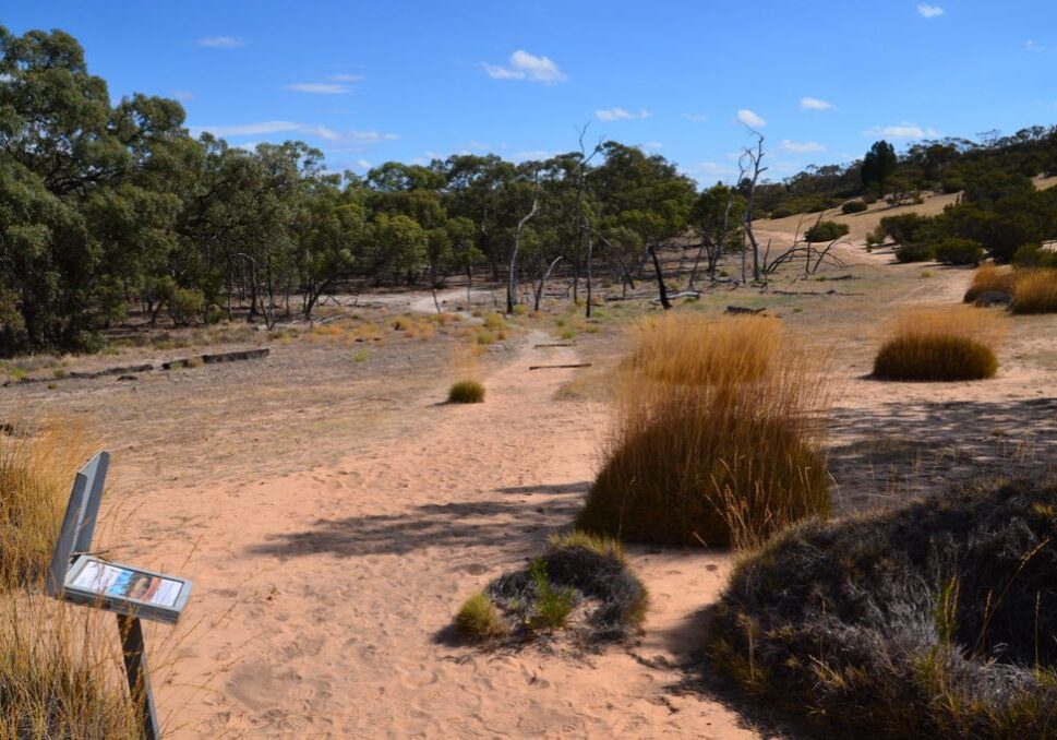
This relatively easy interpretaive walk provides a great introduction to the landscape and flora and fauna of Victoria's remote and arid north west.
The Walk in Detail
The Discovery Walk starts from the Wonga Campground in the Wyperfeld National Park. The start point is aproximately 150m to the east of the large shelter in the middle of the campground.
Do not attempt this walk in hot conditions, and make sure that you carry adequate water with you at all times. While the walk distance is short at only 4kms, there are some short patches of soft sand and many interpretative signs that provide detailed information on the flora and fauna of this arid area, both of which which slow you down.
Look for the signposts for the start of the walk near the rear of the toilets approximately 150m to the east of the large shelter. The walk is signposted with markers along its length and is best done in an anti-clockwise direction. The walk initially passes through Black Box woodlands then on through sand dunes covered in a wide variety of plants including native Pine and Buloke. Approximately 1.5kms from the start of the walk a track junction is reached. The Discovery Walk continutes to the left, however before turning, walk to the crest of the dune ahead for views over a large clay pan and the Devils Pools that in winter and spring will typically contain some water. Approach quietly and carefully as there may be kanagroos or emus at the pools.
Return to the track junction and continue following the track markers and interprative signs of the Discovery Walk. Approximately 750m before the end of the walk the track ascends Mt Mattingley where a lookout provides 360 degree views over the park and beyond. Tesltra mobile phone coverage may be available from here. From the lookout continue on the track back to the campground.
Getting There
If planning on visiting Wyperfeld National Park from Melbourne be aware that the 459km drive will take between five and six hours driving time.
While there are several possible routes from Melbourne, the two common ones are as follows. Both take a similar period of time.
- Take the Tullamarine then Calder freeways, following the signs Mildura. On reaching Wycheproof (approx. 300kms) take left turn and follow signs to Hopetoun via Birchip and Beulah. On reaching Hopetoun, turn left on Yaapeet Road and follow signs to Wyperfeld National Park.
- Take the Western Highway towards Ballarat. After Ballarat take the Sunraysia Highway through Avoca, St Arnaud, Donald then the Borung Highway to Warracknabeal. In Warracknabeal take the Henty Highway to Hopetoun. On reaching Hopetoun, turn left on Yaapeet Road and follow signs to Wyperfeld National Park.
Note: Hopetoun is the last opportunity to buy fuel and supplies before entering Wyperfeld.
Access to Wyperfeld's Wonga campground is along a sealed road from the park entrance. Wonga is very large open area with some shade trees, composting toilets, untreated water and some fireplaces. Bring your own firewoord. Camping fees apply and bookings and payment in advance are required through Parks Victoria.
Walk Precautions
Wyperfeld National Park should be avoided in extreme summer temperatures. The best time to visit is between Easter and Melbourne Cup Weekend.
Additional Information
Wonga Campground (start of walk):

