Distance: 13 Km | Duration: 3.5 Hrs | Grade: Grade 2 | Rating: | Style: Circuit | Map
About the Walk
Overview
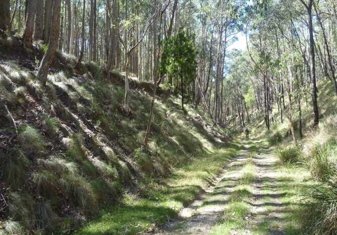
Discover some history of this area when transport was needed to move timber and potatoes and carry people to the mineral springs area at Hepburn Springs. The middle section of this walk encompasses the headwaters of Sailors Creek. This is a circuit walk on paths of varying significance. The walk follows the boundary of the peacefull Yoga Ashram before joining a section of the Great Dividing Trail (GDT) to visit the White Point Diggings site. After some minor road walking , and crossing Sailors Creek, the walk eventually follows a railway easement from yesteryear. This includes bridge remnants, embankments cuttings, a culvert and a former station site. There is an optional scramble down the embankment to look more closely at the perfectly intact brick culvert. The birthplace of the GDT is passed during this part of the walk.
The Walk in Detail
From the start at the Wombat Station rotunda (Grid Reference (GR) 415530) walk north-west on an elevated easement for 470m. Turn right (north) onto a maintenance road for 420m to a T junctions and turn left to follow the boundary of Yoga Ashram. Continue north on a minor road besdie a blue gum plantation. Follow the loop in the track, first east then south, then east again to a track junction at GR 415540. Turn right and walk for 130m to another T junction. Turn left (north-east) and, ignoring a track to the left after 300m, continue for 1km to a track on the right. Continue north-east and take a a right-hand fork. Follow this footpad thorugh to White Point Track at GR 426551. Turn right and walk along the road for 400m to a GDT marker post at GR 430549. Turn left and follow the GST into the bush to the site of the White Point diggings (GR 434550), which can be seen in a gully 600m from Whit Point Track. continue a further 700m to Sailors Creek Road, initially folllowing the course of the headwaters of Sailors Creek.
Turn right onto Sailors Creek Road and cross the bridge over Sailors Creek at GR 438552. Continue along athe road for a further 500m and turn right onto a faint vehicle track (GR 439548), which enteres the forest and curves around to join an old rail easement. Note the old rail bridge remnants on the left a GR 442540. Follow this prominent railway easement for 850m to White Point Track. Cross White Point Track an dcontinue for 2.7km through distinct cuttings, passing the signposted birthplace of GST, to a beautifully crafted and perfectly preserved brick culvert at GR 418526. It is possible to scramble down to the left-hand (west) side of the embankment to inspect the tunnel. It may also be possible to walk right through the tunnel, depending on whether there has been recent rain. Continue along the easement for 500m back to Wombat Station and the start of the walk.
Getting There
From the Base (Hepburn Primary School) turn right onto Main Road for about 4km to Daylesford. At the roundabout intersection with the Midland Highway continue straight ahead on Ballan-Daylesford Road for 10.3km to Sailors Creek Road. Turn right and travel 300m turning left into Leonards Hill-Barkstead Road which becomes a gravel road. After 3.8km turn right onto Rocklyn Road and travel 1.6km to the Wombat Station rotunda and the start of the walk.Walk Precautions
The walk is on gravel roads and foot tracks. Take care walking on minor roads. boots are not necessary and sturdy walking shoes would be suitable. Walking poles are optional
