Distance: 3.1 Km | Duration: 3 Hrs | Grade: Grade 3 | Rating: | Style: Return | Map
About the Walk
Overview
A long drive, but unbeatable views! Situated high on the rugged Victoria Range. Spectacular views of The Fortress and Victoria Range and other Grampians ranges. Interesting scenic drive along the top of Victoria Range and Victoria Valley.
The Walk in Detail
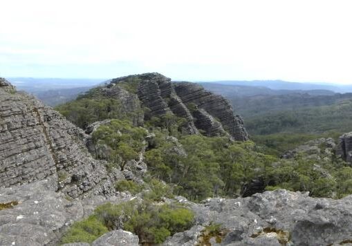
This walk is well worth the long drive. Starting from the carpark, a short stroll through tall forest brings you to a gradual descent down a rocky gully, with Thackeray towering above you on your left and rocky turrets on your right. After 1km, you switch back and begin the rocky scramble up the terraced slope. There are plenty of good foot and hand holds, however, some sections higher up are a little exposed and care should be taken.
The spectacular views soon become apparent the higher you go. After 500m, you reach the summit with its broken trig marker, and some of the best views in the Grampians. The mighty Fortress lies just across the valleys and you can see from Mt Zero – the northernmost tip - all the way to Mt Sturgeon – the southernmost tip of the Grampians.
Enjoy a leisurely lunch here taking in the views, before re-tracing your steps back to the carpark.
Getting There
From Laharum, drive south and then take the Brimpaen Road across to the Henty Hwy. Continue south for 26km. Turn left onto the gravel Billywing Road and follow onto Harrops Track and into Buandik campground, where you then take the Goat Track [4WD only] up onto Victoria Range. Once on top of the range, turn right at the Heli-pad. Mt Thackeray carpark will be 10km on your right. (Grid Ref 185715) Distance to start: 70km Driving time: 1hr 45m. Return: Re-trace the road back to the Heli-pad – turn right (east) onto the Goat Track and follow this across the range and down into Victoria Valley. Follow Syphon Road, then Lodge Road, eventually veering on to Asses Ears Road. After 9km, take Schmidt’s Road north to Brimpaen Road, where you will turn right and make your way back to Laharum. Distance Thackeray to Laharum: 60km Driving time: 1hr 50min.Walk Precautions
Sections of the rocky climb are a little exposed and may not be suitable for people with a fear of heights. Most people cope with this though. Sections of the Goat Track and Victoria Range Road are very rough and rocky and are ONLY suitable for 4WD’s. If there are not enough 4WD’s volunteered by participants, extra vehicles will be provided to cater for the drive.
