Distance: 6.6 Km | Duration: 4.5 Hrs | Grade: Grade 5 | Rating: | Style: Circuit | Map
About the Walk
Overview
This is not a walk for the faint hearted and a good head for heights is necessary! Spectacular views. One of the most exciting walks in the Grampians.
The Walk in Detail
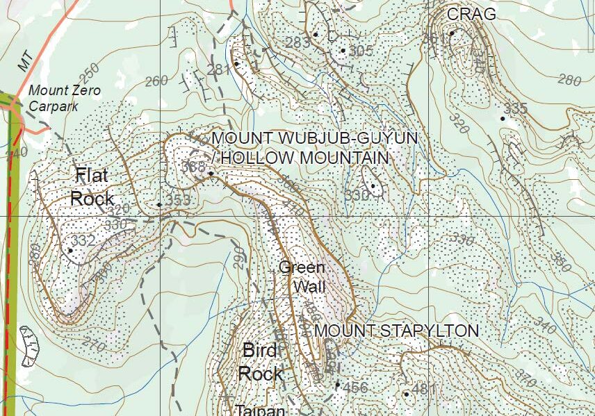
The walk commences from the Hollow Mountain carpark, following the walking track towards Hollow Mt. At the first track junction, turn right. This will lead you past a number of bouldering sites. Rock cairns will lead you onto Flat Rock, which you then ascend. From the top of Flat Rock, there is a great view of your destination.
Descend into the amphitheatre and up past the impressive Taipan Wall. Plan a refreshment break at Bird Rock. Continue up the track, ignoring the turn-off to Stapylton campground. The trail now leads into a gully then swings left up a broad rock shelf, past a deep cave to a marker just below the summit. From here follow some arrows down and around to the north, where you will find a short, but easy chimney climb. A narrow ledge then brings you to just below the summit, which is now just a short scramble away. Enjoy lunch on top with 360° views of surrounding plains and Grampians ranges.
The route down from here is much less distinct and should not be attempted unless you have an experienced leader who knows the way or you have been shown the route before. It involves negotiating several crevasses, crags and some exposed rocky ledges. The route follows the ridgeline down until you reach the top of Hollow Mountain, where you need to very carefully descend down into the top section of the cave. Once inside, take time to marvel at this natural wonder as you descend its three levels and exit at the bottom via one of two options.
If time permits, you can follow a path up and around to the top of Hollow Mountain summit, which provides great views, back towards where you have walked. To finish the walk, simply follow the track back down towards the Hollow Mt carpark.
Getting There
Drive north on Northern Grampians Rd for 3.8km. Turn right onto Pohlner’s Rd. Drive 4.4km and turn left. After 1.4km, veer right onto Mt Zero Rd. In another 1km, you will reach the right turn into Hollow Mountain carpark (Grid Ref 232169). Distance to start: 10.5km. Driving time: 12min.Walk Precautions
Several sections of the rocky climb are quite exposed and would not be suitable for people with a fear of heights. Boots with good grip are essential. Unless you know this walk, it is not wise to attempt it yourself without a guide, as the route is very indistinct along the ridge top.

