Distance: 14 Km | Duration: 5 Hrs | Grade: Grade 3 | Rating: | Style: Circuit | Map
About the Walk
Overview
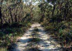
The walk covers an area rich in wildflowers, as well as forest timber. Old gold prospecting activity is in evidence in the area. The walk is significantly off-track over some steep hills and 4WD tracks. We encounter various sections of the early stages of the Werribee River. The final part of the walk along the Werribee River is very picturesque.
The Walk in Detail
The walk starts at the car park at GR 499450. Cross over the river and walk south-east on the road for 400m to a faint 4WD track on the left (GR 502448). Follow this track for 100m then veer north-east off-track to a high point at GR 507451. Follow the 4WD track to the next high point at GR 508453 an continue south-east for 500m to McGees Road at GR 512450. Cross over McGees Road and continue on the track climbing up tot he junction with Mount Hope Track at GR 518452. Turn left on Mount Hope Track and continue for 500m to the junction with Cricket Ground Track (GR 516455) and north for about 1.5km to Hell Hole Track on the left. Ignore this track and proceed for 200m to a faint track branching tothe right (GR 519468) and follow this track east tothe sumit of Mount Hope (GR 521469). This is a convenient place for a break. It is a cleared area with weather station apparatus but has no views.
Continue following a track north-west down to Mount Hope Track (GR 520470) and continue north ignoring any sdie tracks until you reach the top of the ridge where the track is on a long sweeping right hand bend at GR 520475. There is a small clearing on the left hand side to help identify this spot. Turn left (north-west) and wal off-track to pick up the long generally down, but undulating, ridge passing a high point at GR 514476. Continue on the ridge, avoiding the creeks and gullies on your left, to reach another high point at GR 503482 which is about 2km from going off-track. This area is a good lunch spot.
After lunch continue west over the high point along a trail bike track for about 50m and pick a convenient spot to leave the bike track and head west, ignoring all other bike tracks, until a distinct 4WD track is reached at the bottom fo the hill (GR 498482). Follow this track north-west to Spargo-Blakeville Road at GR 495485. This is where the most mining activity has taken place so care is needed. Continue from this high point south to pick up a 4WD track and follow this track south for 1km to a T junction at GR 492471.
Turn right along a 4WD track to another junction (GR 491471) and cross into the bush for a short distance wet aiming for a break in the fence that leads to a mown gress track called Sultana Road. Follow this road, which becomes gravel, between private properties, and cross the Werribee River. Continue on to a clearing on the left-hand side containing a shed at GR 486468. Head off-track south, then south-west up a hill to meet the Ballan-Daylesford Road and a 4WD track at GR 486464. Follow the 4WD track as it turns south-west for about 1km to the ford over the Werribee River (GR 495461). Do not cros the ford but follow the riverside walk south on the west side of the river. This track meanders along the river for 2.2km to the car park. Look out for the dogleg left-hand turn on the track (GR 498448) this is a shorter route back to the car park.
Getting There
From the Base (Hepburn Primary School) turn right on to Main Road and follow this east and south for about 4.4km to Daylesford. Continue south on the Ballan-Daylesford Road. After about 26.5km from the start look for a gravel road to the left that is signposted Bunding-Blakeville Road. Take this road for 1.3km to a picnic area at the bottom of the hill o the left hand side of the road. This is the start and finish of the walk (Grid Reference (GR) 499450). There are no car park gates or fees payable.Walk Precautions
Old gold prospecting ventures have left random tranches and min pits so care is needed in some areas. Gaiters and long pants would be helpful to negotiate the tall bracken and undergrowth. Boots are necessary due to rough terrain.
