Distance: 6 Km | Duration: Hrs | Grade: Grade 4 | Rating: | Style: One Way | Map
Best Season: Summer, Autumn, Winter
About the Walk
Overview
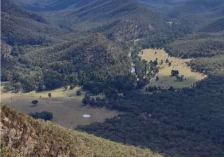
Views and more views. The Licola Wilderness Village, our accommodation centre, is visible from the high ridge of the Glenfalloch Station grazing paddocks. Mount Ligar “The Crinoline”, FedWalks 2021 signature peak, is ever present on the north eastern skyline. The casuarina forest is a feature on the slopes of the steep descent at the end of this hike. Its pine needle like leaves make the descent more challenging.
The Walk in Detail
This walk is offered with the permission of the management of Glenfalloch Station for the Federation Walks 2021 event only. This walk offers spectacular views to the west along the Macalister River valley and even more beautiful vistas to the north and east as you make your way down off Mount Eliza. Start walking east from Stony Creek, investigate the ruins of a homestead from a bygone era. To get great views we need to climb and climb. Initially the walk is through steep cleared pasture with panoramic views to the west taking in the river valley and the Station’s river flat grazing land; and the second half offers vistas to the north and east revealing the Crinoline, Mount Sugarloaf, Long Hill, and Mount Tamboritha to name just a few. After leaving the cleared farmland, the track passes through an area of immature wattles before breaking out at Mount Eliza. The going is a little easier now. There is lots of evidence of deer activity on this part of the walk. It is proposed to stop at the summit of Mount Eliza for a short time as better uninterrupted views present themselves a little further down the track to the north. There are no amenities nor water on the track. Sturdy footwear and gaiters are recommended. Walking poles are highly recommended particularly for the steep ascents and steep off-track descent.
Getting There
From Licola Village, head west back towards Heyfield, cross the Macalister River and continue towards Heyfield for 2.7 kilometres. Immediately west of the Stony Creek bridge seek out suitable safe parking on the side of the road. The hike commences through the farm gate on the eastern side of the Heyfield / Licola Road. Shut the gate. This walk requires a short car shuffle of approximately 7 kilometres with cars also to be left on the south side of the Tamboritha Road 3.7 kilometers north of Licola.Walk Precautions
Walking poles are recommended for the steep ascents and descents.
