Distance: 14.5 Km | Duration: 5 Hrs | Grade: Grade 3 | Rating: | Style: Circuit | Map
About the Walk
Overview
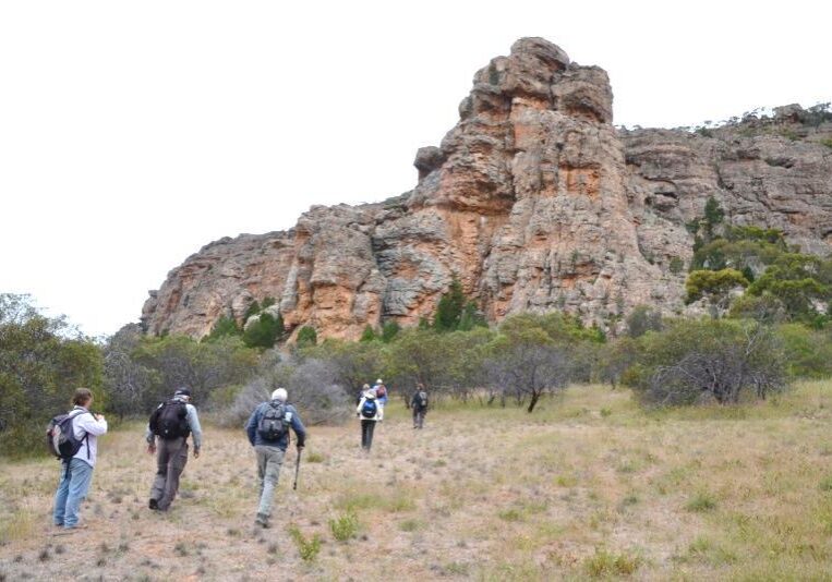
Seeing all aspects of this popular mountain, including towering cliffs, rock climbers and wildflowers.
The Walk in Detail
Following the walking track south from the picnic ground, ignore the turn off to Declaration Crag and continue on. As the track dips, take the footpad on your right which leads to Bushranger Bluff. You can either enjoy an interesting scramble up and over this outcrop or simply veer around it to the left. Follow the walking trail out to the carpark, then turn left andfollow the bitumen summit road forabout 500m to the Nature Walk carpark.
If time permits, you can complete the short loop walk, otherwise when you reach post 4, follow the well worn Kangaroo pad to the Seismology measuring station on the edge of the Natimuk Golf Course. Cross the course and follow the fairways south to the most south west tee. Head due west from here and very shortly a fire dam will be located, with the 4WD track around the mountain just beyond it.
Follow this 4WD track, turning right at a T-Junction. After another 1.3km, a signpost guides you a short distance to the Major Mitchell monument – almost on the very edge of the park. After a break here, return to the track and continue on. You will soon obtain views of Mitre Lake and Mitre Rock and other features further on the West Wimmera Plains.
Continue on the 4WD track until you are now walking on the eastern Park boundary. Look for a track on the right marked ‘Walkers and Management Vehicles Only’. Follow this until it starts to turn. Take the climbers track up closer to the cliff line and follow this all the way back to the Pines camping ground, admiring the many climbs and the cliff face lit by the afternoon sun. Keep an eye out for climbers!
If time permits at walks end, take the cars up the Summit Road to the top and take in the 360⁰ views of the Wimmera plains.
Getting There
The route for this drive will take you north then west from Laharum, across to Noradjuha, then in via Natimuk and out to the Pines Campground at the foot of Mt Arapiles (Grid Ref 758315). As there are many turns, the leader will have a more detailed route map for this drive. Note: there is an 8km section of gravel road, with the rest bitumen. Distance to start: 67km Driving time: 50min.Walk Precautions
Be mindful of traffic when walking the short section of bitumen road early in the walk.
