Distance: 18 Km | Duration: 5.5 Hrs | Grade: Grade 3 | Rating: | Style: Circuit | Map
Best Season: Summer, Autumn, Winter
About the Walk
Overview
The walk starts at the Blowhole on Sailors Creek and follows an old water race descending to an old charcoal burning site and then climbing to the basalt plateau west of Daylesford. The walk visits Boots Gully, Henderson Spring and the hamlet of Basalt then descends to Bald Hill Creek. There is a steep climb out of the gully then a gradual ascent to Bald Hill before descending to Tipperary Springs and following the Goldfields Track along Sailors Creek back to the start.
The Walk in Detail
The walk starts by taking the 100 steps down to the Blowhole "beach" to view the northern end of the diversion tunnel cut through the ridge by miners in the 1850s. Take the 13 steps up the west side of the creek bank and turn right (north) on the signposted Diggings Walk. After 55m the track swings to the left and climbs south-west up the spur above the cutoff segment of Sailors Creek for 450m through alluvial mining rock heaps, to an earth embankment just short of a pine post marked with two arrows. Turn right onto the embankment, which was formerly a water race, and follow it for 1km to meet a four way vehicle track junction on a saddle at GR 439671. Cross the track coming in from the left and continue north-west to follow the water race for 200m to the first big bend then head north off-track down the spur for 200m to the floor of the gully and a rough vehicle track. Turn left and cross a creek bed then veer left at an indistinct fork at GR 438674. (The right fork continues to a large dam on private property.) Pick up a faint track heading sout-west, which becomes an indistinct former vehicle track, for 500m as it heads uphill alongside a gully to meet Yam Gully Road at GR 433673, where there is an old charcoal-burning site. continue uphill on the track, which is now Blowhole Track, for 200m, takin a right fork near the ridge to then turn right (north) onto a well-defined vehicle track.
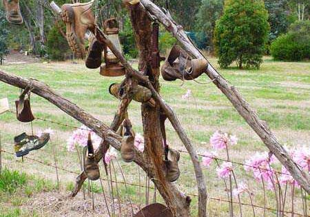
Follow thetrack fro alomost 1.3km along the ridge over a summit then down to Basalt Road, at GR 429681. Turn left down Basalt Road for about 400m then turn right onto Henderson Spring Track which starts heading north-west and swings south to Boots Gully. form the end of the vehicle track follow a small water race another 100m to the spring. It is named after Gordon Henderson who stoned up the spring in 1925. He was captured at the fall of Singapore and died as a POW on the Burma railway. Cross Boots Gully at the spring and climb steeply straight up the hill to a vehicle track. Follow this track uphill to the left (south-east) then right (south) to Basalt Road.
At Baalt Road turn right heading south-west, then south-east for 1km to the junction with Old Werona road at GR 425669. Turn right and walk south-west for 500m to its juncton with two diverging tracks at GR 421667. Take the left track and head south-east for 1.1km to the Charlesfork Track and Basalt Road intersecton. Tun right onto Basalt Road and walk south for about j100m and turn left onto Pfeiffers Track at GR 428657, which is marked by a whimiscal gas cylinder letterbox.
Follow Pfeiffers Track for about 2.5km, descending gradually to the Bald Hill Creek crossing then gradually ascending to meet Bald Hill Road at GR 440644. Turn right (south) on Blad Hill Road then after 500m turn left (east) on a vehicle track and follow this track for 1.3kn to Tipperary Springs. Follow the walking track north onthe wet side of Sailors Creek for 3.3km to Bryces Flat (GR 448659) and then about 1.5km on the Great Divding Trail to the Blowhole and the start of the walk.
Getting There
From the base at Hepburn Primary School, turn left into Hepburn-Newstead Road and continue for 700m to Eighteenth Street. Turn left and follow this road for 800m and turn right into Blowhole Road. Continue for a further 600m to the Blowhole parking area (Grid Reference (GR) 446669).Walk Precautions
Foot tracks need care while walking due to fallen timber. The foot along Sailors Creek has narrow sections which traverse the steep slope of the valley. Care is needed while walking on roads, and vehicle tracks can have a loose surface requiring care going downhill. Boots and gaiters are advisable in creek and gully areas. there are inconsistencies between maps and terrain. Major tracks are on the ground that do not appear on the maps.

