Distance: 15 Km | Duration: 5 Hrs | Grade: Grade 2 | Rating: | Style: One Way | Map
About the Walk
Overview
Views of Mt Difficult Range. Scenic walk along running creek. Fish Falls & McKenzie Falls.
The Walk in Detail
This walk is part of a proposed walking/cycling trail for the Wartook Valley region. After setting up the car shuffle (above), commence walking from the Wander Inn, north along the roadside for 470m until you reach a gate marking the start of the trail. Follow the track, which borders farmland on your left and the swampy floodplains of McKenzie Creek on your right. Lovely views can be had of the rugged Mt Difficult Range as you walk this section. Just as you enter the forest, remains of an old fish farm can be found just off the track to your right.
A further 1.2km sees you crossing the Mt Zero Channel, followed soon after by the ‘Dad & Dave’ weir. The 4WD track continues on through some granite country, occasionally coming close to McKenzie Creek, until you eventually reach Zumsteins picnic ground. This is a good spot for lunch and a comfort stop.
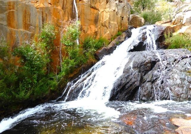
After lunch, commence the signposted track to McKenzie Falls. This is now a well formed foot pad and closely follows the flowing creek the rest of the way. This is a pretty section of the walk, with ferns now regenerating after the fires. Another good spot for a break is Fish Falls - a beautiful series of cascades.
A further 800m sees you enter the main gorge, with its impressive steep rocky cliffs. A new series of metal walkways and steps provides a stunning approach to the base of McKenzie Falls. Rest a while here to enjoy the view of these iconic falls, before finally commencing the steep climb up the path to the carpark. From here, drive back to the Wander Inn and collect the remaining cars.
Getting There
Drive south on Northern Grampians Road for 11.7km and park at the Wander Inn carpark (Grid Ref 191003. Walk north 500m to the gate at start of the track (Grid Ref 193005). Distance to start: 11.7km Driving time: 8min. NOTE: At walks end, a bus will ferry walkers from the top of McKenzie Falls back to their cars at the Wander Inn.Walk Precautions
Some parts of track could be muddy if there has been recent rain.
