Distance: 14 Km | Duration: 5 Hrs | Grade: TBA | Rating: | Style: Circuit | Map
About the Walk
Overview
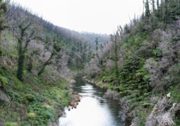
This walk visits the historic Poverty Point Bridge built in June 1900. At this point the walk joins the Australian Alps Walking Track. You will enjoy varied mountain and river valley scenery. Interpretive signs along the track explain some of the history of the 'golden' days.
The Walk in Detail
This walk visits the historic Poverty Point Bridge built in June 1900. At this point the walk joins the Australian Alps Walking Track. You will enjoy varied mountain and river valley scenery. Interpretive signs along the track explain some of the history of the 'golden' days.
From Rawson head East along Old Depot Road down to the Thompson River. Follow the riverside track upstream to Poverty Point Bridge. Cross the bridge and follow the Australian Alps Walking Track till it intersects Mormon Town Track. Follow Mormon Town Track downhill and cross the Thomson River again on the road bridge. Visit Thomson Station.
After visiting Thomson Station head north and then west up Old Depot Road back to Rawson.
Getting There
From Moe, 130 km East of Melbourne on the Princes Highway, drive to Rawson 36.2 km amd 41minutes from Moe. Take the Moe-Walhalla Road C466, turn right onto Knotts Siding Road C481.The walk starts at Rawson.
