Distance: 14 Km | Duration: 5 Hrs | Grade: Grade 3 | Rating: | Style: Return | Map
About the Walk
Overview
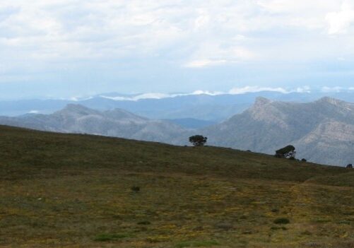
An iconic alpine walk through snowgum woodlands and alpine meadows ending above the tree line at Mt Howitt with spectacular views of Mt Hotham, the Crosscut Saw, Mt Speculation and Terrible Hollow.
The Walk in Detail
The track begins as a gentle 4.5km walk through button grass plains and snowgums to Vallejo-Gantner Hut and Macalister Springs. A 2.5 km moderate climb onto the treeless high plains leads to the Mt Howitt cairn. The ascent is one of the most beautiful in Victoria featuring alpine meadows, weathered snow gums and wonderful views. The return journey is on the same tracks back to the car park. From the car park head north on a signed foot track. The track descends slightly and links to the original cattle droving pad and 4WD track. Veer left and continue across tiny Clover Plain. At 3km, pass the original cattle pad on the right, signed Zeka Spur, which descends to the Wonnangatta Valley. At 4.2km, take the left fork for 800m over a small rise and down a short, rocky descent to the double-storey, A-frame Vallejo Gantner Hut and Macalister Springs camping area at 1600m elevation. Morning tea. Head west downhill past Macalister Springs to a saddle. To the north of the track is Terrible Hollow. Climb the other side of the saddle and, literally just above the treeline at the southern end of the Crosscut Saw, take the left (west) path joining the Australian Alps Walking Track. Climb a moderate gradient to the summit cairn of Mt Howitt (1742m). Lunch. On return when at Macalister Springs, head up a lesser foot track climbing uphill to the east. This track has views of the Razor and the Viking before it swings southward through snow gum forest to rejoin the main track. Turn left (south), 3.8km to the carpark. Water and a toilet at Macalister Springs and a tank at the hut.
