Distance: 8 Km | Duration: 3 Hrs | Grade: TBA | Rating: | Style: Return | Map
Best Season: Summer, Autumn
About the Walk
Overview
Follow a jeep track into history to investigate an old marble quarry overlooking the Thompson River. Marble from the quarry was used in the William Bailey Mansion in Ballarat and also Rupertswood Homestead in Sunbury. Two lecterns in St. Paul's Church, Ballarat East, and a counter top in Australia House, London.
The Walk in Detail
The start of the walk is on a jeep track that goes through an area that was clear felled many years ago (~1955?) for sawlogs and pulpwood for the Maryvale Pulp and Paper mill. The tree species are mainly Silvertop (Eucalyptus Sieberi) and Red Box (E. polyanthemus). The jeep track ends about 300 metres past the turn off to the quarry, at the top of a steep fall down to the Thomson River. There are gentle downgrades along the jeep track for about 4 km.
Approximately 300m from the start, the track forks; take the right hand fork. At 2.1km the track forks again. Take the left hand track here. At 3.6 km, just before the end of the jeep track and a steep drop down to the Thompson River look on the right for an old tramline track. Follow this track for approximately 350m down to the quarry.
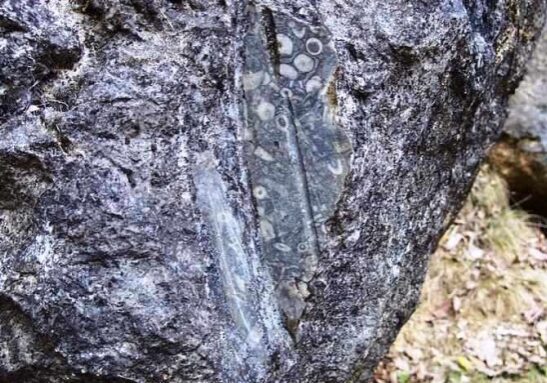
While the actual quarry is small in area and not a lot remains to be seen, spend some time contemplating the remoteness of the mining site and the difficulties experienced in removing and transporting the marble. There are some boulders of black marble with clear surfaces showing many fossils. 30m above the quarry site is an open, unfenced shaft which is at least 20 metres deep. This should be approached with extreme caution.
The quarry was discovered in 1873. The marble was used in the William Bailey Mansion in Ballarat and also Rupertswood Homestead in Sunbury. Two lecterns in St. Paul's Church, Ballarat East, and a counter top in Australia House, London, are also made from this material.
