Distance: 8.5 Km | Duration: 6 Hrs | Grade: Grade 3 | Rating: | Style: One Way | Map
About the Walk
Overview
Aboriginal art sights, panoramic views of Grampians from the west, walk rugged cliff line, explore caves.
The Walk in Detail
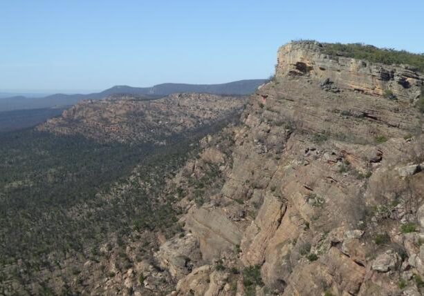
The walk starts at Mudadgadjin Picnic Ground and proceeds south up the steps to an Aboriginal Art site. The track proceeds down across a sandy flat and up to the base of the cliffs. Traverse up left (east) following rock cairns to the corner of the cliff line for spectacular views to the east. From here, head south along the base of the rugged cliff line until the main gully is reached (parts of this section are a little exposed – care should be taken). Proceed west in to the top of the gully, then back eastward again, climbing to the top of the cliff line. The track then heads south soon reaching the high point of the walk, marked with a rock cairn (set about 50m in from the cliff edge). Lunch can be enjoyed anywhere along the cliff top, enjoying the expansive views of the Grampians. The track now continues south along the cliff line with navigation becoming a little harder towards the end as a result of damage from the 2015 fire.
Reaching the end of the cliff line, where the foot pad heads down west, continue instead straight ahead off-track to the end of the range and drop down to explore the magnificent Wildman’s Cave.
From here, walk south (off-track) and down to Muirfoot Track to where the vehicles were left.
Getting There
From Laharum drive south then west through Brimpaen to Henty Highway. Continue south 8.5km to Cherrypool, turn right onto gravel road and continue 7km to HGH corner (T-Junction). Turn left and drive for 5.5km, then right on to Muirfoot track for 2.5km to a gate - the walks end point (Grid Ref 957870). Cars to be left here with a bus trip to the start of the walk. Distance to start: 44km Driving time: 40min.Walk Precautions
Exposed section of track. At times the track passes close to exposed areas and sudden drop offs. This is not a walk for those uncomfortable around exposed areas and heights. Large sections of this walk are through recently burnt areas. Care should be taken to watch out for burnt sharp sticks, fallen trees and uneven ground.
