Distance: 16 Km | Duration: Hrs | Grade: TBA | Rating: | Style: One Way | Map
About the Walk
Overview
This walk passes through a grass tree forest, has views over farmland and rocky coastline and you may see wildlife. Requires a car shuffle.
The Walk in Detail
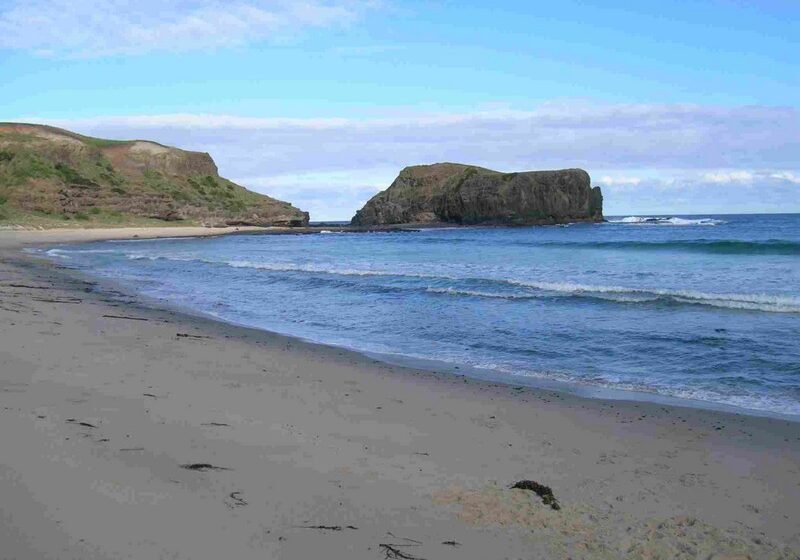
Baldry's Crossing-Two Bays Track-Greens Bush-Long Point Track-Bushrangers Bay-Cape Schanck Starting at Baldry's Crossing picnic area, cross the the road and follow the Main Creek track where you will see nice views over farmland above a steep embankment. Continue along the main track and ignore other side circuit tracks on the right. Walk through the bush past a small creek & boardwalk until your reach an open area. This was a bush airstrip for the Green family farm. At the other end of the airstrip is the site of the Green family farmhouse.You will see good views over the Main Creek valley and Bass Strait. Walking further you will descend into a valley and come upon a grass tree forest. Drop down until you cross Lightwood Creek and reach the track junction. Continue along Two Bays track to Long Point Track junction. Follow the track south passing the Long Point Track and finally climb to an open area with good views over the farmland towards Meakins Road. Just a bit further on you arrive at Boneo Road. Carefully cross the road, through the carpark and keep walking south and you will pass through a look alike rainforest area and also good views over rolling hills. You will often see some kangaroo around this area. When you reach a track junction go down to Bushrangers Bay, where you could easily spend an hour or more exploring the beach, creek and rock pools. Warning: do not swim in the surf at Bushrangers Bay. The beach is isolated, not patrolled and you are a long way from help in an emergency. Paddle in the creek instead. Return back uphill to the Two Bays walking track track, passing over a bridge at Burrabong Creek and then more good views overlooking the cliffs as you near Cape Schanck. You will then arrive at the Cape Schanck car park, where if time permits go down the stairs to the boardwalk at the Cape. Return back to the car park which is the end of the walk.
Getting There
Drive to Rosebud at at Jetty Road turn south past the Rosebud Primary school, past the Freeway until you join with Browns road. Continue along Browns Rd until a roundabout at Purves Rd. Continue straight ahead about 2.2 kms and you will reach Baldry's Crossing.Walk Precautions
Requires a car shuffle.
Additional Information
Cape Schanck 

