Distance: 6.5 Km | Duration: 2 Hrs | Grade: TBA | Rating: | Style: Circuit | Map
About the Walk
Overview
<p>Starting from Sheoak Picnic Area, this walk winds down Sheoak Creek to Swallow Cave, and the beautiful Sheoak falls, then returns to the start point.</p>
The Walk in Detail
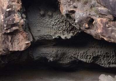
Park cars at Sheoak Picnic Area. Beyond the information board, locate the sign board for Swallow Cave, Sheoak Falls, Coast. Take this track, which follows the Sheoak Creek. Continue straight ahead at the turn off for the nature trail.
At the track junction continue straight ahead to Swallow Cave and then return to the junction. Turn left towards Sheoak Falls. Cross the creek on flat stepping stones if the water level allows, and continue up steps, past the Castle Rock track sign to a viewing platform for Sheoak Falls.
A better view of the falls exists a short distance further down the track. Return up the steps, over the creek, past the Swallow Cave turn off and up to the turnoff on the right for the Nature Trail. Turn right and then left at the next junction to return to the Sheoak Picnic Ground and the cars.
Walk Map
To view more on the map, zoom in or out, click the symbols and the walk route. To open a full screen version of the map, right-click ![]() and open in another tab or window. An image of the map can also be
and open in another tab or window. An image of the map can also be ![]() downloaded319.63 KB.
downloaded319.63 KB.
Getting There
From the Great Ocean Rd in Lorne turn into Otway St (Melways 518 F6), drive to the roundabout and follow signs for Allenvale and continue for 1.5km to the Sheoak Picnic Area.
Walk Precautions
Additional Information
Sheoak Picnic Area 


